Old Smelter Site
(22 September 2017)
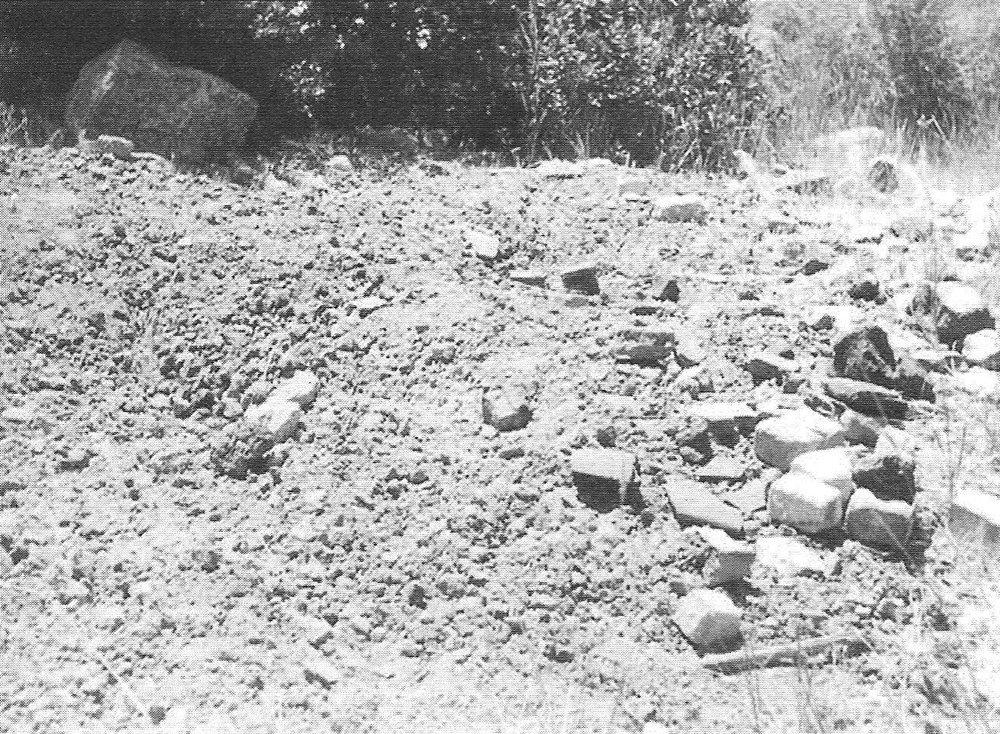
Armed with this photo of the ruins of an old smelter site taken by Bonnie Kane (local museum) in 1972, we set out to try to find the location on a warm summer afternoon (on 17th July 2017). Bonnie had described the approximate location of the site as being in upper San Emigdio Canyon, so we had a specific area in which to focus our search.
We anticipated it was going to be a difficult task to find this old smelter again. After the passage of 45 years, we assumed very little would be left of the old smelter works. For example, we expected most of the fire bricks to have been picked up over the decades by passing hikers as souvenirs. This turned out to be the case.
The photo gave us the false impression that the ruins were lying on a slope. So despite extensive searching of sloping ground in the area we were unsuccessful in finding the site during our first attempt. As the sun was dipping towards the surrounding mountain tops, we turned back home satisfied we'd given it our best shot. We'd have to try again another day.
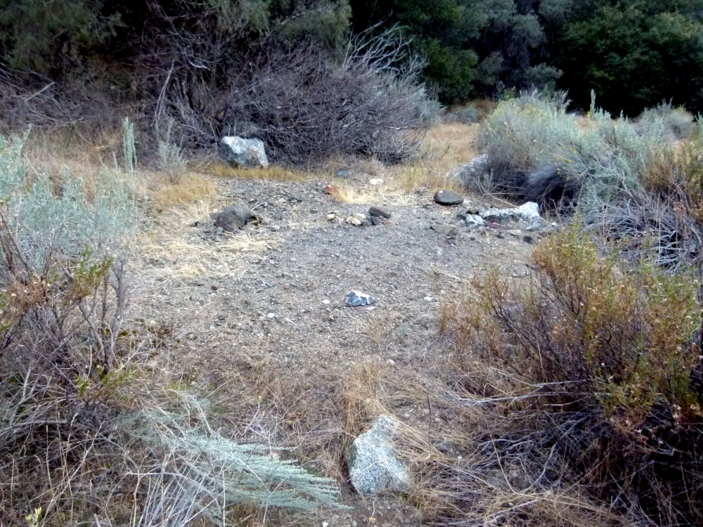
We changed tactics on a second attempt two months later. There is a distinctive looking boulder seen in the background of the photo (top right), so we decided to try and find that boulder. This led us to an area on flat ground (not on a slope) that showed signs of substantial environmental damage because nothing was growing there. On closer inspection, this turned out to be the site of the old smelter we were looking for.
The old smelter (or what is left of it) is located about 100 yards north-west of San Emigdio Creek measured from the junction where two creeks meet. This junction is where the main trail heading to Wind Wolves crosses San Emigdio Creek, so it is a distinctive spot. The creek coming from the east side flows from a swampy area to the north of the Whitener Tree that starts higher up the canyon near the old youth camp below "the Y" intersection. This adjoining creek roughly follows Mil Potrero Highway as it descends from "the Y" toward Pine Mountain Club and drains that watershed. On topo maps, this creek is named San Emigdio Creek so it is the main creek which usually flows year round. The other adjoining creek flows down from the Nesthorn area of Pine Mountain Club and is often dry lower down. It is an unnamed tributary (or if it has a name, I'm unaware of what it is).
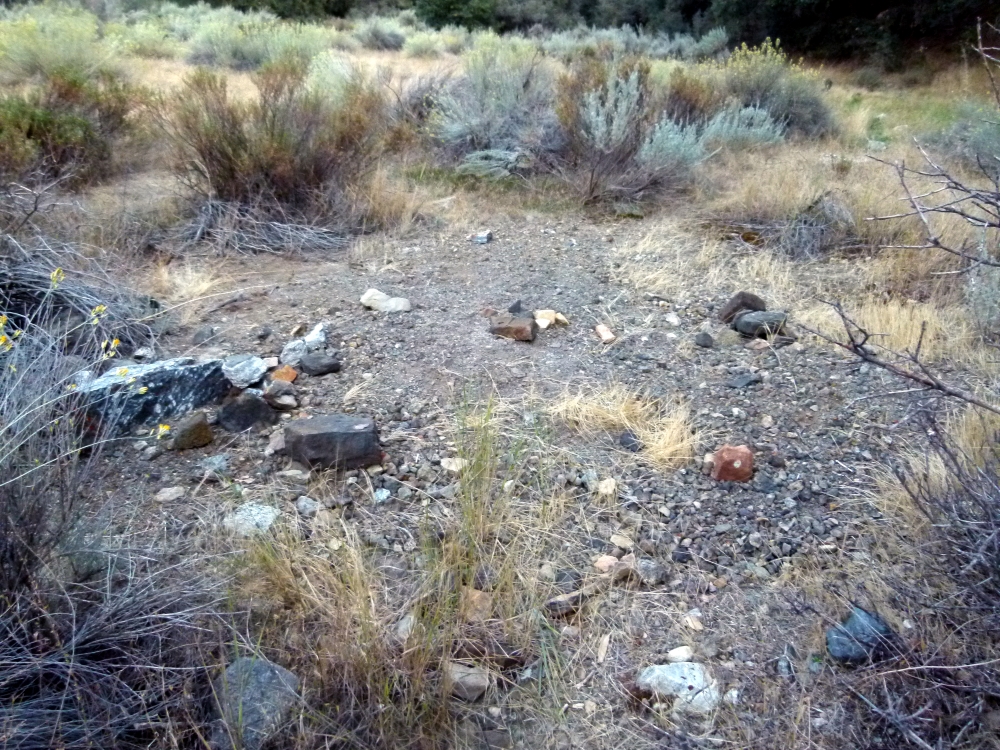
Very little evidence remains to identify the site. There were no whole fire bricks remaining on the surface. The main evidence found were some broken pieces of fire bricks and samples of slag.
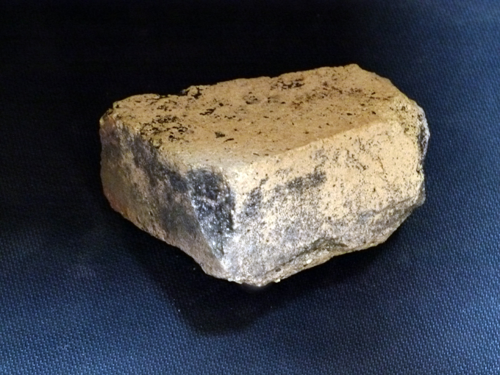
A fragment of a fire brick found at this site. It measures 4-inches, by 3-inches, by 2-inches. The three flat surfaces are at 90-degrees to each other. It is not a freak of Nature as there is nothing else like it in terms of size, color, weight, composition etc. in the natural rocks and geology found in that area. This fire brick looks similar to the fire bricks to be found at another smelter site which is a mile further down San Emigdio Canyon. Those smelters were built around 1878 by Boushey & Co. So this gives us a reference to help with dating other smelters in the area.
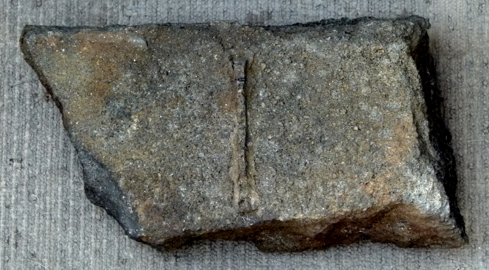
The strongest evidence that this is an old smelter site is the slag that remains, mostly as fragments but some large pieces. Slag is a byproduct of the smelting process that is discarded. An example of the slag is seen in the photo above. The vertical ridge line in the center of this sample strongly suggests this was man made and is not naturally occurring. Moreover, the composition and weight of the slag was completely different to all other rocks in the area leaving little doubt that this is indeed slag.
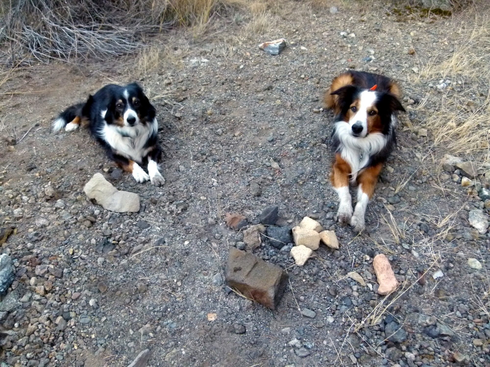
The single most distinctive feature of the site is that the ground under the old smelter is completely barren where nothing has been able to grow back in all this time. The large sample of slag pictured above can be seen in the center foreground of this photo.
I can only guess at the vintage of the smelter.....I'd say late 1800s or early to mid 1900s. I'm assuming these works were used for smelting antimony from a nearby source on Antimony Peak. The base of Antimony Peak is just 200 yards away.
There is one reference in the historical record to mining in upper San Emigdio Canyon that might fit this site.
Charles B. Fife of Frazier Park shipped about 5 tons of ore from San Emigdio Canyon in 1941 during WW II when prices for antimony had increased (making the mining of antimony
more profitable). The increased price for antimony probably reflects the increased demand for this metal during the War.
Fife had leased the claim from the Kern County Land Co. who had previously purchased the claims in the area in 1892.
Charles Fife doesn't sound like a miner himself but may have employed workers to mine and ship this antimony ore in 1941.
Although speculation, Fife may have financed the building and operation of this smelter in upper San Emigdio Canyon.
Appearances are it was a small-scale operation which is consistent with a relatively small amount of ore that was shipped.
The smelter may have only been used to assay the composition of the ore rather than used for refining large amounts of the ore to reduce shipping costs.
So my best guess (for now) is this smelter was built and operated by employees of Charles B. Fife around 1941.
The GPS coordinates for this smelter site are:
34-degrees 51-minutes 55.62-seconds North
119-degrees 7-minutes 47.67-seconds West
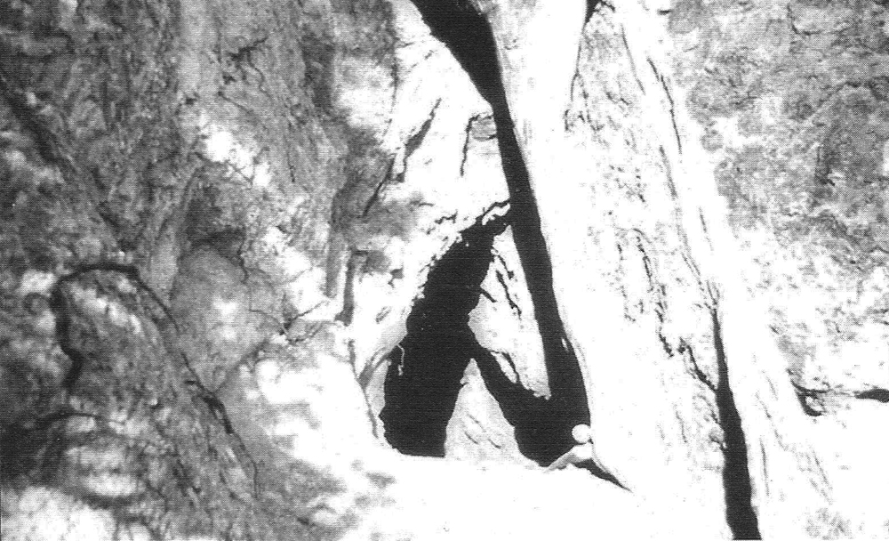
The photo below was taken in the 1980s of an opening in a nearby canyon at the base of Antimony Peak that might possibly be associated with this smelter works. Although there is no evidence to connect them so far.
![]()
Peter Gray
telephone: +1 (661) 242-1234