Independence Mine
(29th October 2011)
: We revisited this mine on 6 July 2016. Another local hiker, Matt Barr, reported seeing a mother bear and two cubs sheltering inside the mine about a week earlier. The mine shaft was empty when we were there but there was fresh bear scat near the entrance. Needless to say, approach with caution.
*********************
This relatively short hike to a 1960s-era, hard-rock mine is an off-trail hike but very close close to the outskirts of PMC. I suspect the mine is inside the official "city limits" (although probably only just).
The GPS co-ordinates for the mine are:
Latitude: 34 degrees 51 minutes 34 seconds North
Longitude: 119 degrees 08 minutes 50 seconds West
The starting point is not far from the end of Nesthorn Way. The distance to the mine is slightly less than half a mile (.44 miles each way) with just over a 500 foot gain/loss in altitude there and back.
Relaxed hiking time is about 30 to 40 minutes for the ascent which includes numerous stops to look around and enjoy the experience.
The mine is below an outcrop just beyond a prominent scree slope of white-ish rocks. You don't see the entrance of the mine until you are right on top of it.
Directions: Follow Nesthorn Way to the end and keep going on a dirt road for a few hundred yards until you come to a gate (usually locked). Note: this is the first gate or PMC gate and not the Windwolves gate much further down.
This upper gate is the starting point for this interesting hike. It is about a 30-40 minute hike each way to the abandoned mine. There is a faint trail in places but you are mostly finding your own route. The higher you get the easier and prettier this hike becomes.
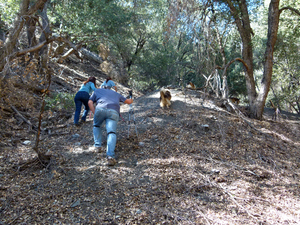
From the gate, head up the side canyon in a generally northerly direction favoring the right hand side of the canyon as you ascend. The canyon is very broad when you set out but narrows as you climb higher. No matter which way you go, you will be funnelled towards a well-defined, rocky creek bed which is usually dry. Then follow the rocky creek bed in a generally north-westerly direction. The canyon forks to the right higher up and you need to take the right-hand fork. This is key to finding your destination.
After (approx) 15 - 20 minutes of climbing, you need to continue along the right-hand fork of the canyon and not the left-hand fork (which continues straight ahead).
The GPS co-ordinates for where the canyon divides and you need to turn right:
Latitude: 34 degrees 51 minutes 26 seconds North
Longitude: 119 degrees 08 minutes 46 seconds West
It is not immediately obvious where the canyon forks so you need to pay attention. However, if you look carefully, you'll see another canyon joining in on your right-hand side. It has a lot of vegetation (including tall reeds). This is at a point where the water course ahead starts to get really steep and full of loose rocks and becomes very hard to climb higher.
You will notice a rough path that leaves the rocky water course heading off to the right. Follow that. It is pretty easy hiking from that point onwards and the branch canyon is very pleasant. Go about another 15 - 20 minutes to reach the mine site. You'll notice several piles of tailings as you go up this pleasant little canyon. This will confirm you are in the right place. It also suggests there are other mines higher up in this canyon yet to be re-discovered.
^ ^ ^ Climbing up the the right-hand branch canyon. The mine opening is still a couple of hundred yards ahead.
Look out for a largish rock outcrop or rock face ahead on the left side of the canyon (pictured below) with a scree slope of tailings just before it of whitish rocks (the scree comes down from higher up so possibly from another mine?). Walk to the bottom of the rock face (near a fallen tree), and you'll see the mine opening.
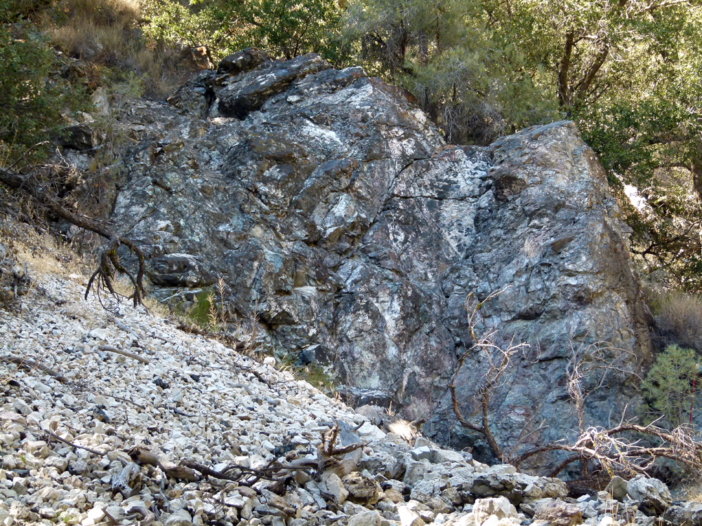
^ ^ ^ This is the rock outcrop you are looking for on the left side of the canyon. Note the scree slope of whitish rocks coming down on the left in front of the outcrop. Also note the fallen tree on the lower right. The entrance is just behind this dead tree. When you stand near the dead tree, you will see the mine opening easily.
^ ^ ^ The mine appears to be following an intrusion (mineralized vein) that you can see along the ceiling on the left-hand side.
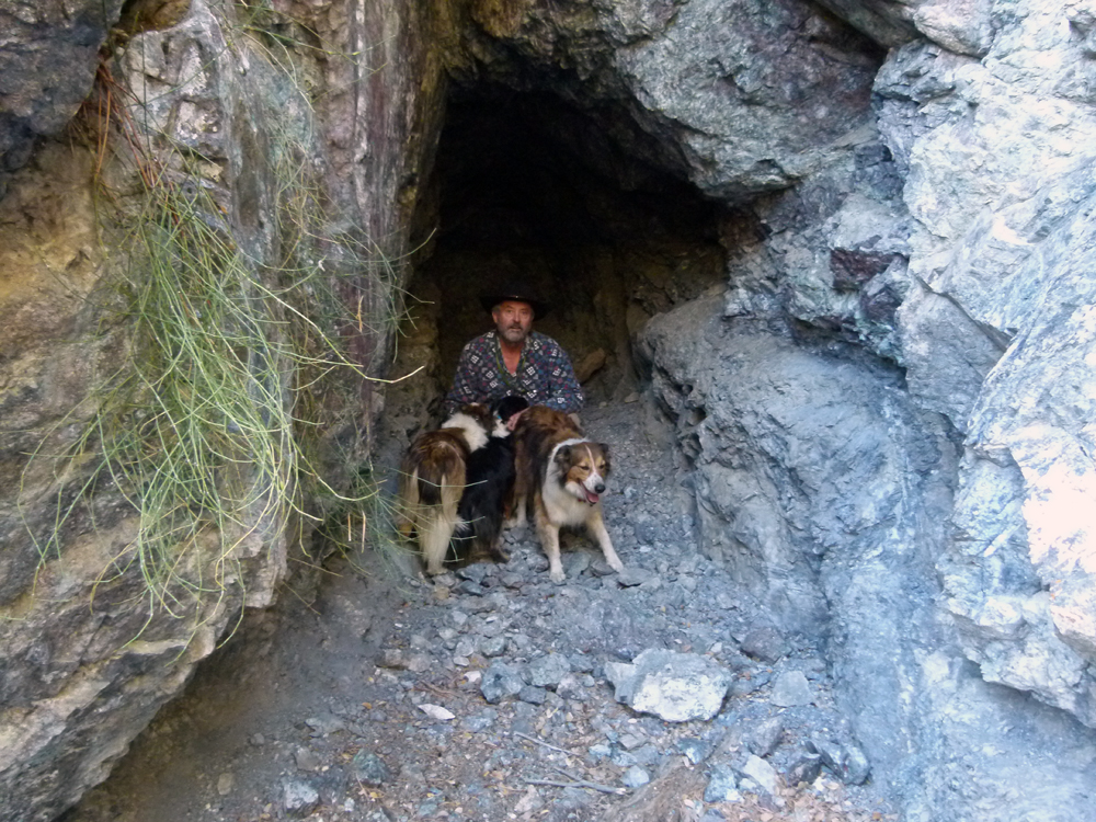
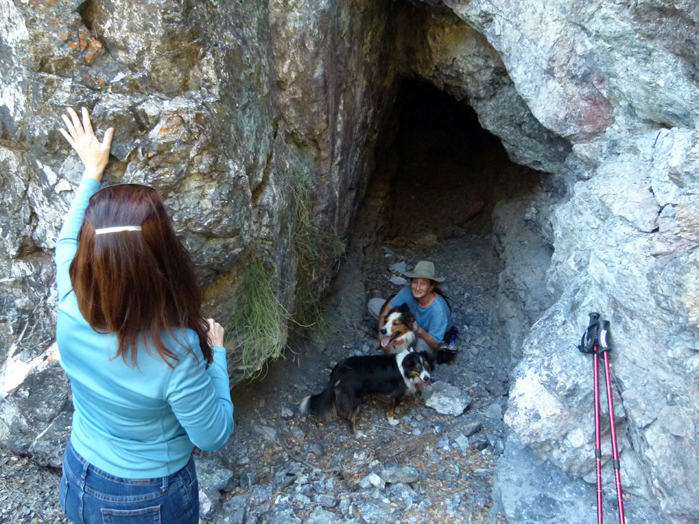
^ ^ ^ The shaft is cut in solid rock (without support bracing) and is about 15 to 20 feet in length. You can stand up inside. Always exercise caution entering old mine shafts. Snakes or wild animals may be sheltering inside.
A hiking companion found a claim marker in an old rusty tin-can marking the corner of the original mining claim. The paper inside the tin can is extremely fragile and partly disintegrated making it very hard to handle and read. The paper indicated the claim was issued to Peter Apostolos on 18th November 1962. He called the mine Independence #2. Mining records indicate Peter Apostolos was mining Magnetite.
Magnetite is common iron oxide (Fe3O4) and is the most commonly mined iron ore. It is also the mineral with the highest iron content (about 72%). Magnetite is ferrimagnetic meaning it is attracted to a magnet and can be magnetized to become a permanent magnet itself. It is the most magnetic of all the naturally-occurring minerals on Earth. Naturally-magnetized pieces of magnetite, called lodestone, will attract small pieces of iron, which is how ancient peoples first discovered the property of magnetism.
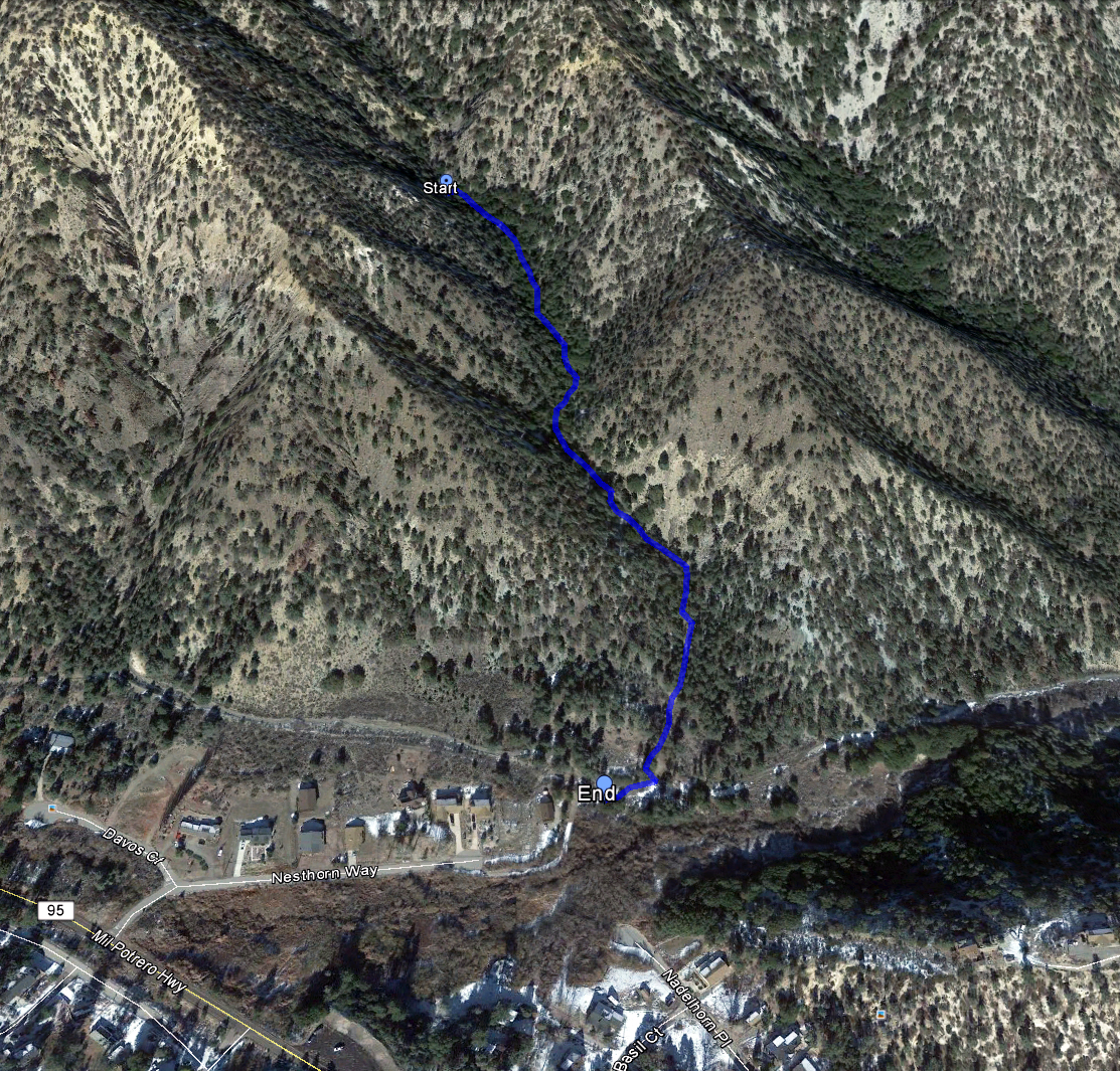
The "big picture" of how to get to the mine (as photographed from space). This is a GPS track of the descent superimposed on a 3-D map from Google Earth. You follow the same route both up and down. Notice the (critical) turn to the right just past the half way point.
![]()
Peter Gray
telephone: +1 (661) 242-1234