Landslide on the old Ridge Route
(June 4th, 2005)
![]()
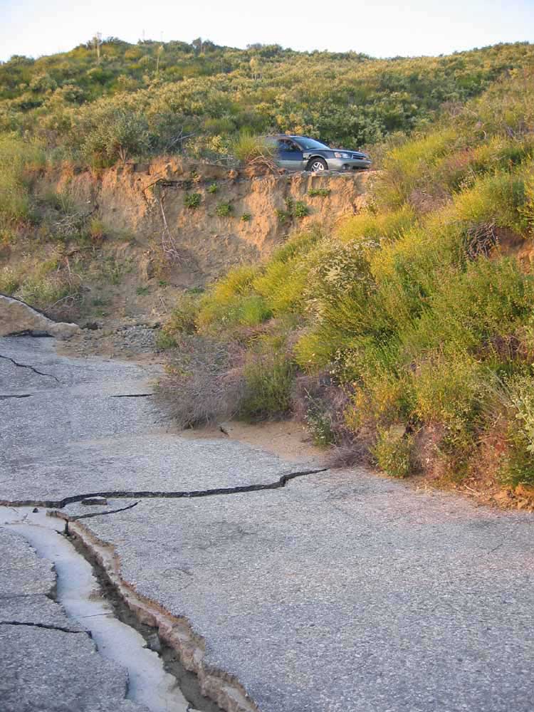
^ ^ ^ This is the section of Old Ridge Route where the road is abruptly severed by a landslide. The location of this slide-damaged area is 15 and a half miles from where the Old Ridge Route (Country Route N2) turns off and goes up the hill from the 138 highway near Quail Lake. Or it is 13.3 miles from the temporary road block / road barricade adjacent to the Pine Canyon Road (aka West Oakdale Road) turn off. The slide area can be approached from either end of the old Ridge Route.
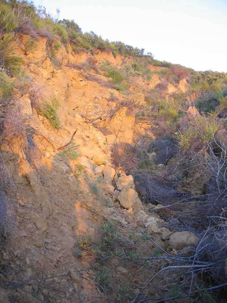
^ ^ ^ This is the north side of the slide area. The original roadway went straight ahead here, but now a section of the roadway has shifted both sideways and also downwards to the right, as can be seen in this photograph.
^ ^ ^ The south side of the slide area where the roadway is also abruptly severed.
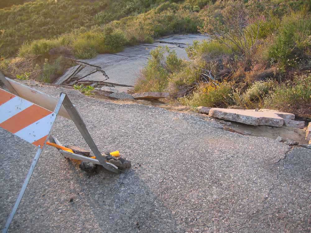
^ ^ ^ Likewise, approaching from the south, the original roadway went straight ahead here, but now a section of the roadway has shifted both sideways and also downwards to the left, as can be seen in this photograph.
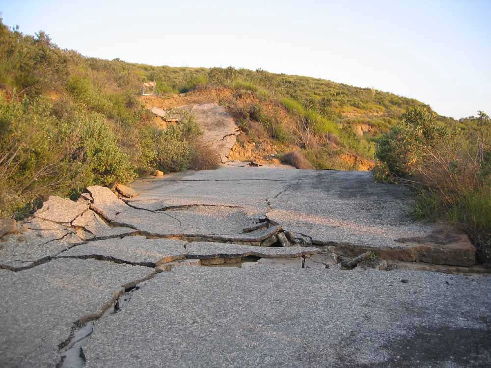
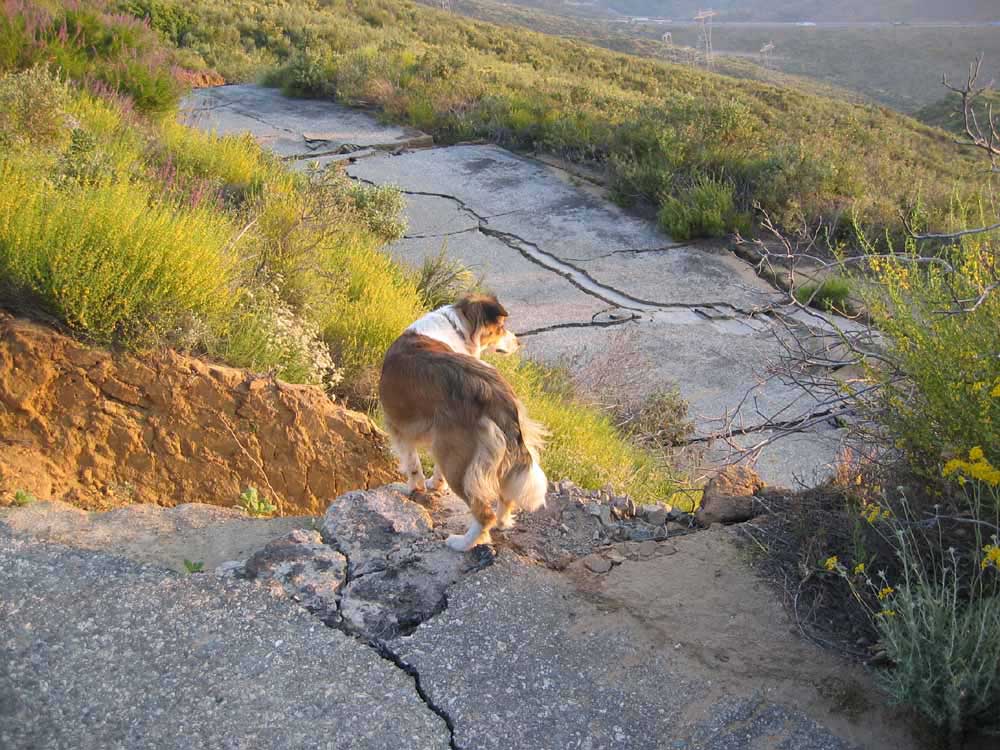
^ ^ ^ The road is crumpled by the movement of the land in the center of the slide-damaged area.
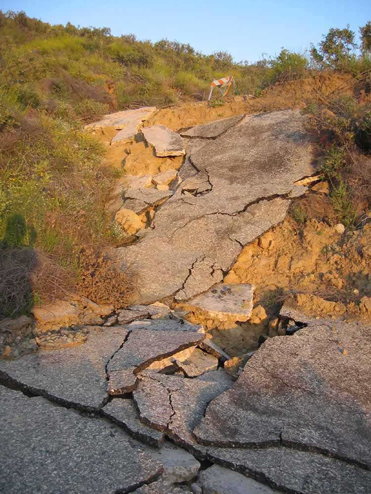
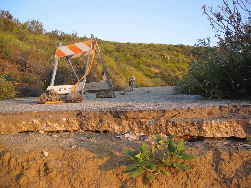
^ ^ ^ The displacement of the land is shown dramatically in this shot of the south side of the slide-damaged area.
^ ^ ^ The same section seen from another angle.
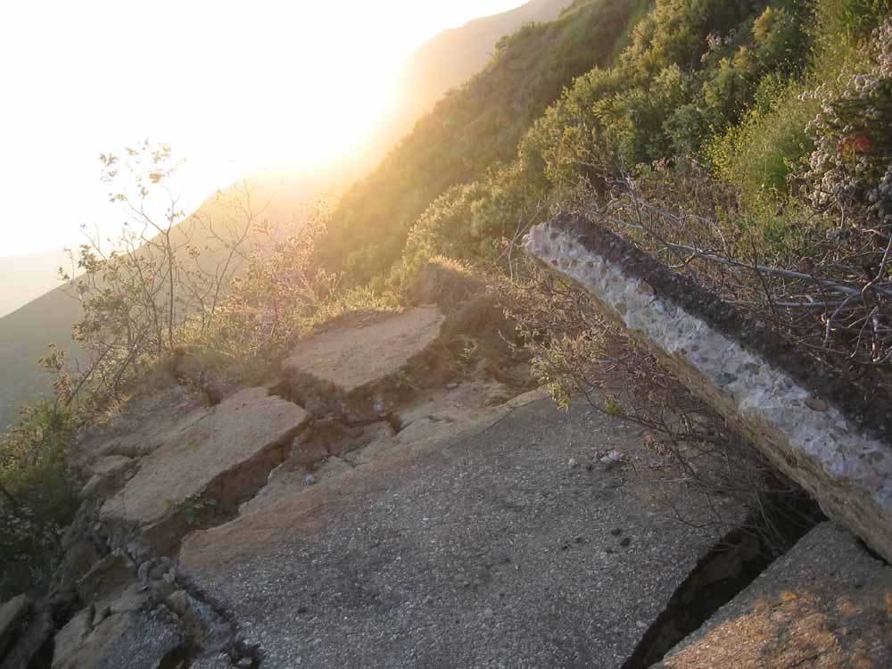
^ ^ ^ There is pronounced crumpling of the road surface materials along the sever point on both the northern and southern edges of the slippage area.
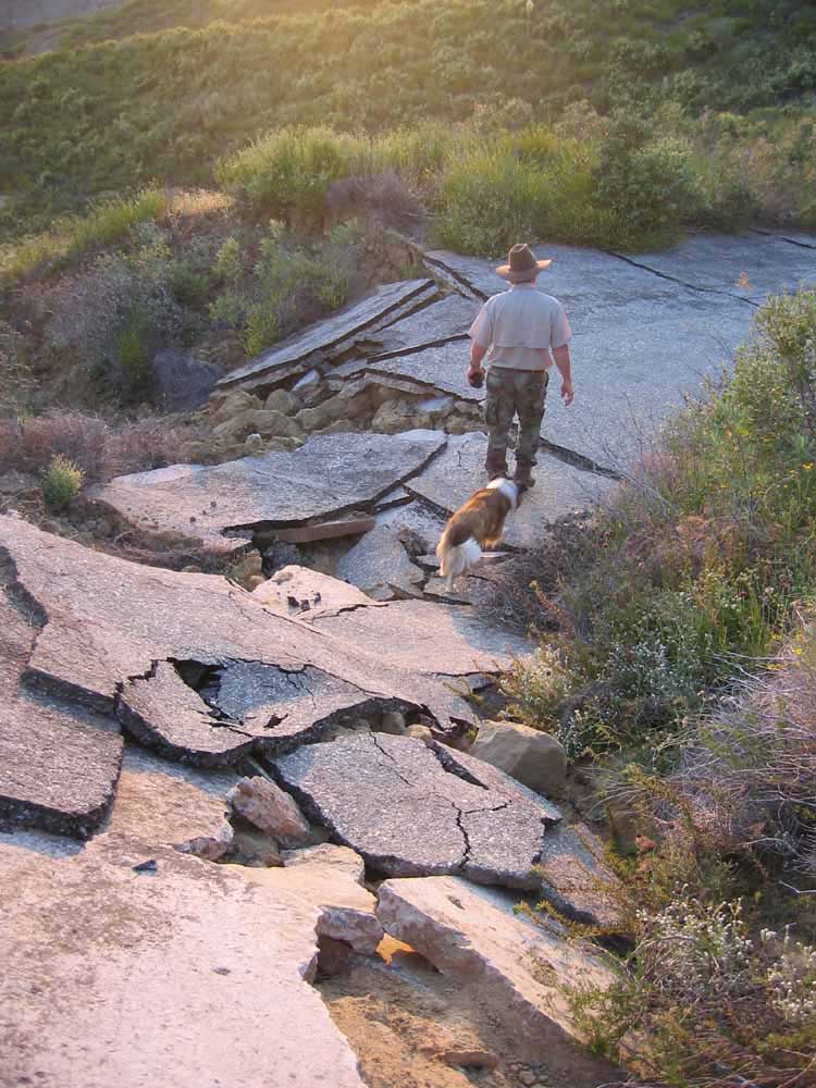
^ ^ ^ This shows the area where the land separated. A large chunk of land to the right of this photo slid down in one huge piece with all the shrubs and bushes remaining in place relatively undisturbed.
This following information is courtesy of the Ridge Route web site dated April 9, 2005, and updated on June 17, 2005.
The 1915 Ridge Route has been officially closed by Angeles National Forest due to extensive damage as a result of the record rain fall in January, 2005. Angeles Forest closed the road because pipeline companies are operating heavy equipment on the road to repair their lines damaged during the record rain fall earlier in the year. For safety reasons, repair crews do not want to have to deal with unauthorized vehicles travelling this route. Unofficial entry onto the road could result in being issued a citation.
A 26 inch natural gas line has been temporarily placed on the road because the hillside supporting it slipped down the canyon. Unauthorized vehicles traveling in this area could hit the line causing a possible explosion and fire. Repair crews have been told to notify the district ranger if anyone is on the road without permission.
Although most slides have been removed, 8 locations on the Old Ridge Route are severely undermined. The most spectacular is two miles south of Swedes Cut, where a 75 foot stretch of the Old Ridge Route slipped 15 feet down the canyon making it impossible to pass over even with a 4-wheel drive vehicle. The photos below show the extensive damage at this location.
Southern California Edison Co. lost a 220 thousand volt metal high line tower. The Southern California Gas Company's 26 inch natural gas line has been severed in three places. Pacific Pipeline Co. has suffered approximately two million dollars in damages and Exxon-Mobil is working to stabilize a hillside above the Old Ridge Route that threatens to sever their crude oil line.
For the past 72 years Angeles Forest has maintained the Old Ridge Route. When storms damaged the road Angeles Forest applied for and received federal aid for repairs. Currently Angeles Forest WILL NOT request federal aid due to a dispute with L. A. County as to the ownership of the Old Ridge Route. Angeles Forest claims L. A. County owns the road and vice-versa. Documents uncovered by the Ridge Route Preservation Organization (RRPO) suggest the Old Ridge Route, once a state highway was given to the county of Los Angeles in 1933 when it was replaced by U. S. Highway 99.
Without further maintenance by Angeles Forest, this National Register Historic California treasure is in critical danger. Drainage problems on the Old Ridge Route need immediate attention otherwise additional sections of the road will slip down the canyon. Due to the legal issues outlined above, the road will probably be closed for at least 12 months.
More news, information, and photographs are available from the official Ridge Route web site: http://www.ridgeroute.com
As a point of interest, there have been three highways over the years. The original 1915 highway, followed by the 1933 three-lane Ridge Alternate Highway known as Highway 99 (converted to a 4-lane expressway in 1947), and today's 8-lane I-5 freeway completed in 1970.
![]()
Peter Gray
telephone: +1 (661) 242-1234