Ridge Route To Knapp Ranch
(29th May 2005)
![]()
Frank Knapp was born in North Tyrol in Austria in 1899. He immigrated to America with his mother and father when he was seven. Frank's father was a defrocked Catholic priest who got a nun in trouble (the nun was not Frank's mother.) Frank's father was a gifted stonemason, and built a castle-like mansion on two acres in Canoga Park in the 1920's for $3000.
Frank Knapp had one son who was a Mustang fighter pilot in World War Two. Tragically, his son was shot down in 1944 over Frank's hometown in Austria. Frank really took the news hard, and divorced his wife over the incident, as she had encouraged the boy to enlist while Frank was vehemently opposed.
Like his father, Frank learned the stonemasons trade. He later worked with the renowned William Mulholland (1855 - 1935). Frank said after the 1928 San Francisquito dam disaster, Mulholland's hands were always shaking like a leaf. When the workmen ate lunch, Mulholland wouldn't join them, but remained aloof, going off somewhere to the side to eat lunch with his own thoughts, all by himself.
Frank Knapp also worked for King Gillette of Gillette razor blade fame. Gillette built an estate with lots of elaborate stonework in Malibu Canyon. King Gillette became obsessed with finding the Los Padres Gold mine in the late 1920's and early 1930's and Knapp helped Gillette search for the legendary mine in Bear Canyon. At one point, Gillette hired a seer in 1932 for $100 a day. After 4 days of hiking Bear Canyon, the mystic shuddered in the middle of the creek bed, and shouted "it's here, the gold is right under us 17 feet down!" Gillette ripped a shovel out of Frank's hands and started digging frantically. The mystic then told Gillette, "Stop. It won't do any good. The spirits of four Indians are guarding the treasure, and they'll move it as soon as you get close."
Frank Knapp bought the ranch in 1962, and it has been known as the Knapp Ranch ever since. The previous owner, Kelly sold it to Frank Knapp after he was severely beaten by some guys in his horse pasture in 1962. Frank said that Kelly was really messed up by the incident and ended up with some permanent neurological damage. The incident begs the question was Kelly beaten to forcefully extract information about the Los Padres Mine?
Frank Knapp died in 1988. Joe Knapp, Frank's brother inherited the ranch, and owned it until he died in 1992. The ranch was then sold by the nephews and nieces to an organization called Friends of the Forest bankrolled by Rosie Greer, who had a ranch over by Lake Hughes, for a price of around $400,000. Rosie Greer then swapped the ranch to the forest service for 200 acres of forest service land that abuts their ranch over in the Lake Hughes / Lake Elizabeth area.
This account is based on a letter written by George Raino, a 6th-grade schoolteacher living in Boise, Idaho, who worked for Frank Knapp in the mid 1970's.
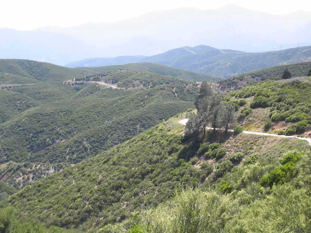
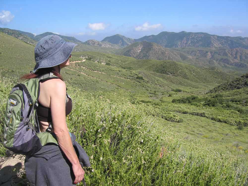
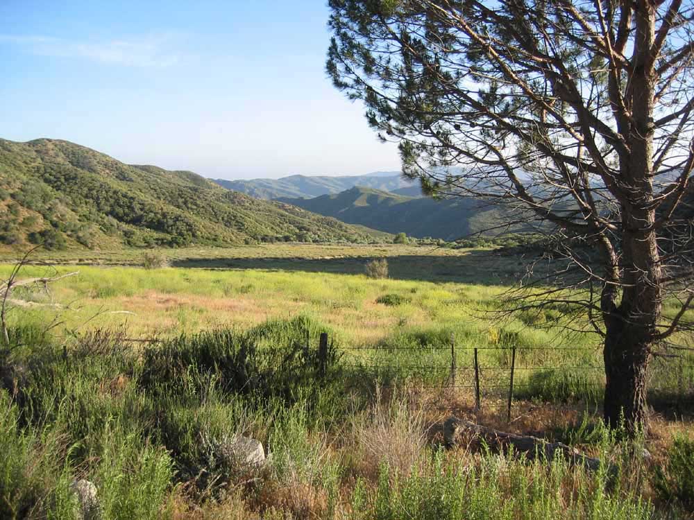
^ ^ ^ Access to the area is from the Old Ridge Route pictured here. This is the view from the trail head, which in this case is a gravel road 7N23, leading to 7N22. A map with full hiking details can be found towards the bottom of this page.
^ ^ ^ The route 7N22 winding its way towards Knapp Ranch and Bear Canyon beyond that. The bare strip up the middle is a curious thing? I thought it might be the surface effects of a fault line. I was told later it is the path of the old telephone line to the ranch, now removed(?)
^ ^ ^ The view just after crossing Salt Creek which flows through a culvert under the roadway.
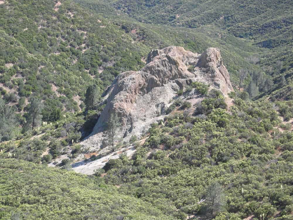
^ ^ ^ There are some interesting rock outcrops along the way. One of the nicknames for this outcrop is the Jesuit Temple. It appears to have hidden Spanish markings in the form of pareidolia which are hidden in plain sight.
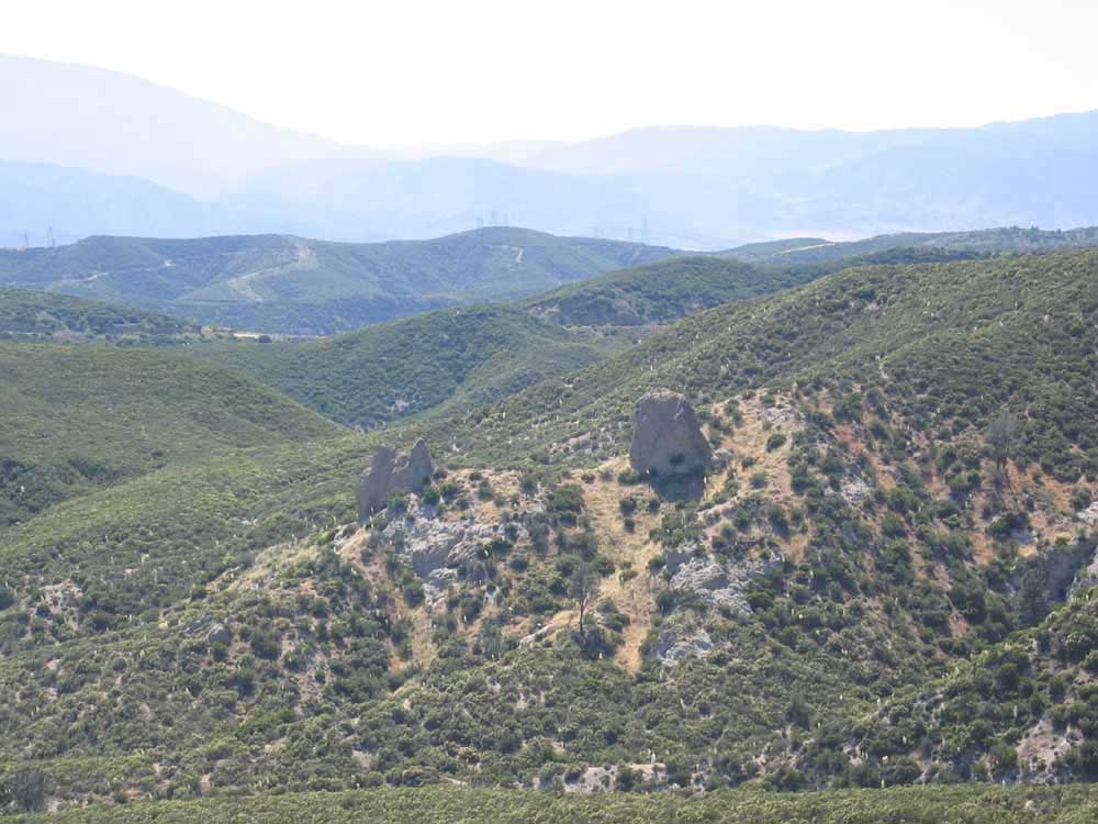
^ ^ ^ More outcrops.
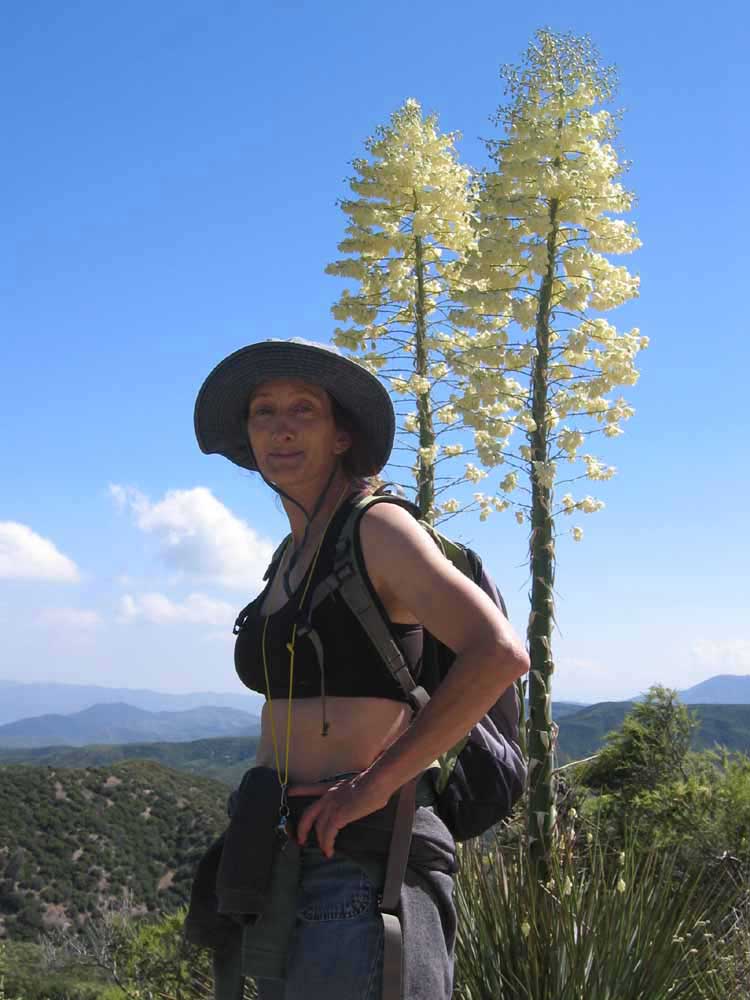
^ ^ ^ A large hat, sunscreen, and plenty of water is a must, especially in the summer months.
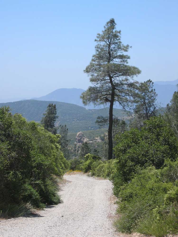
^ ^ ^ As the roadway is exposed along most of the route, it is hard to find a shady spot to rest.
^ ^ ^ Castaic Creek.
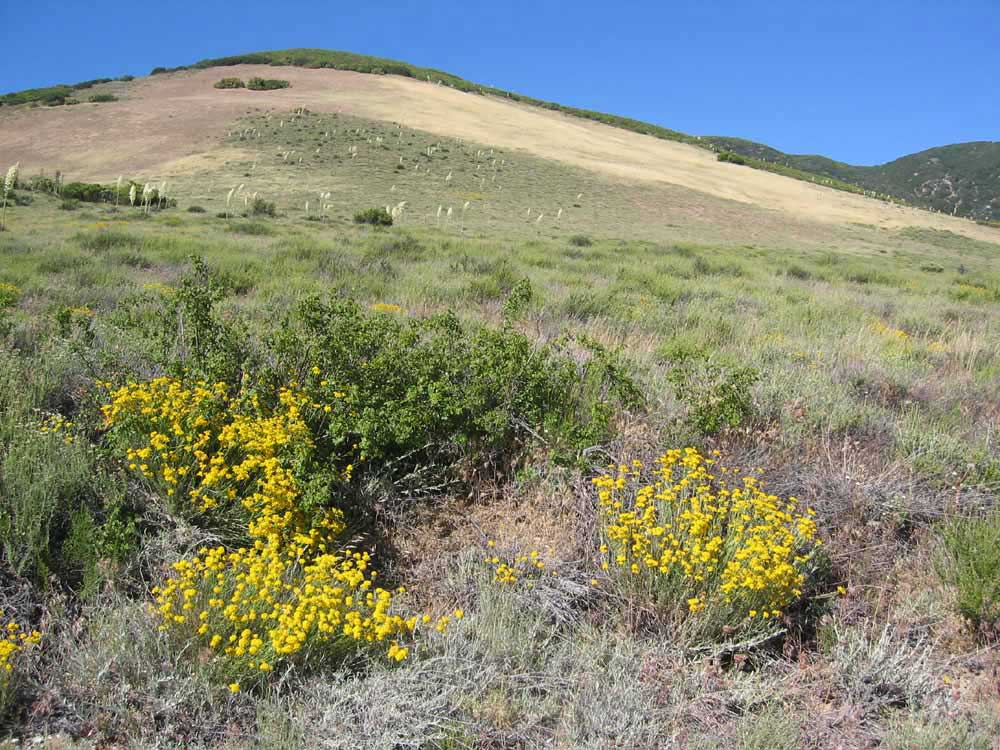
^ ^ ^ A beautiful grassy slope.
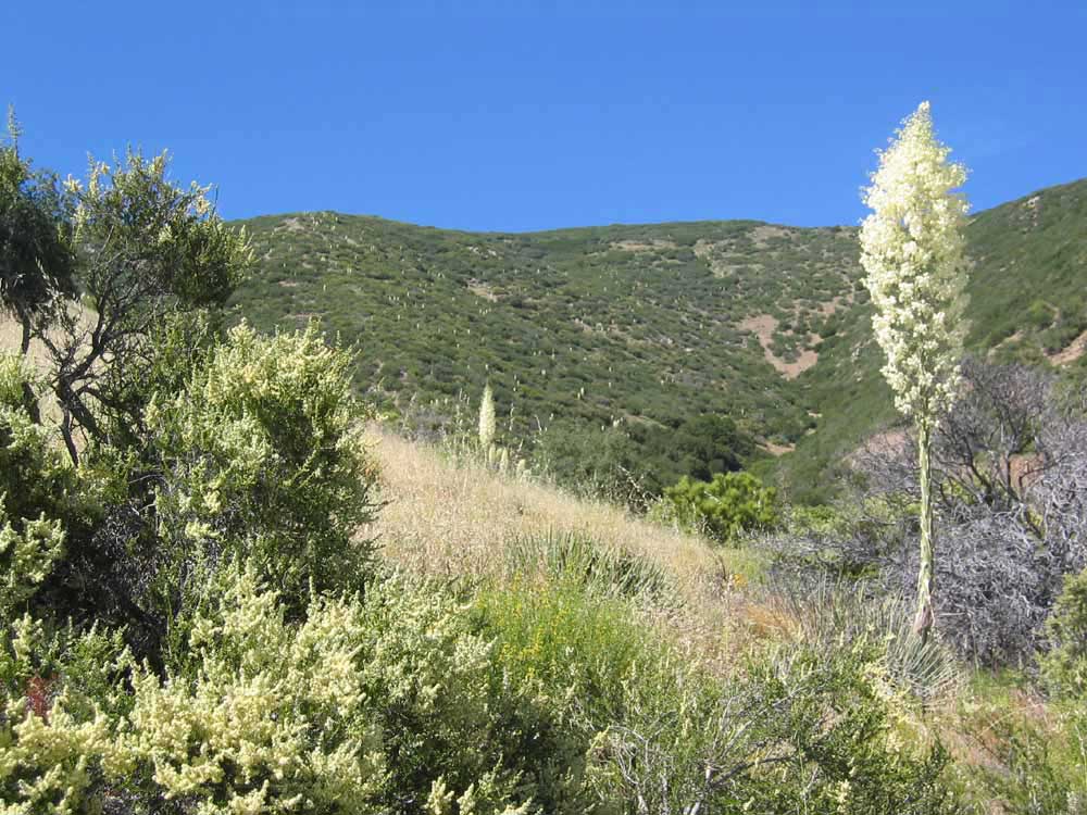
^ ^ ^ A side canyon with blooming yuccas.
^ ^ ^ California Dodder.
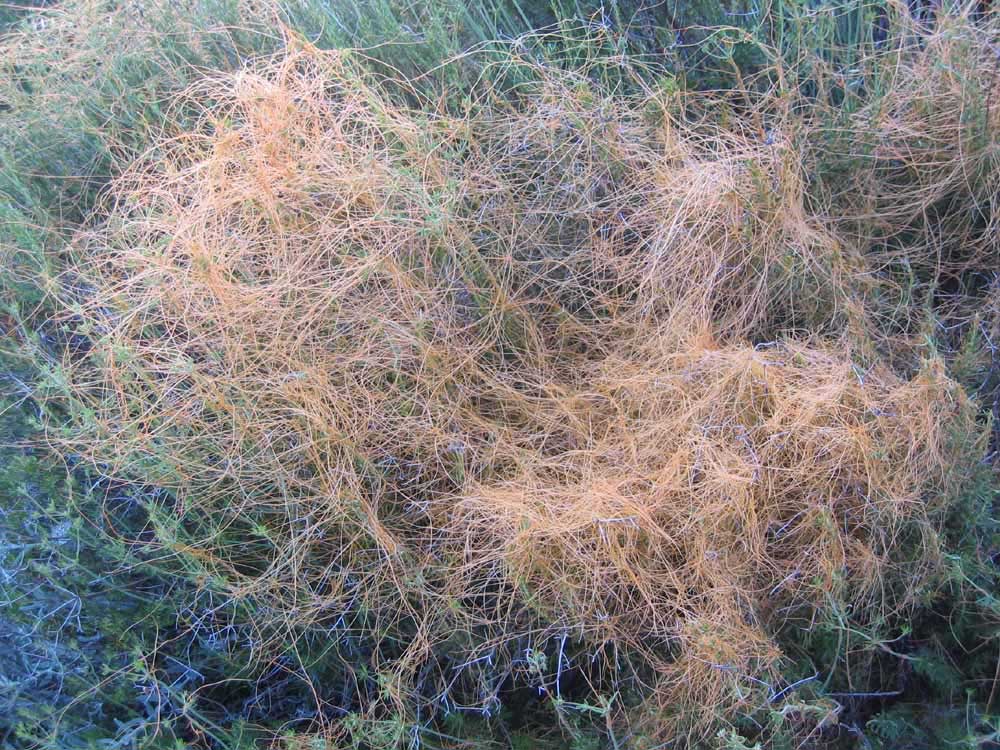
^ ^ ^ Closer view of California Dodder or Cuscuta Californica. This is a parasitic plant, native to California. It is not a grass, but an annual herb or vine. It is sort of wet-feeling and also sticky to the touch.
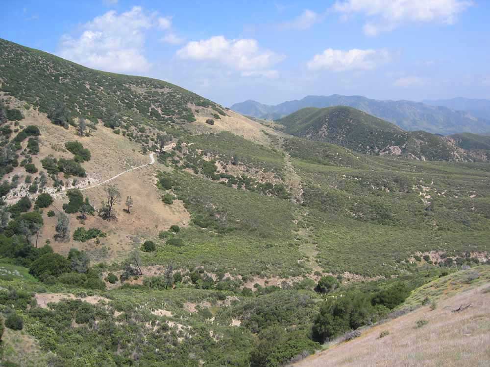
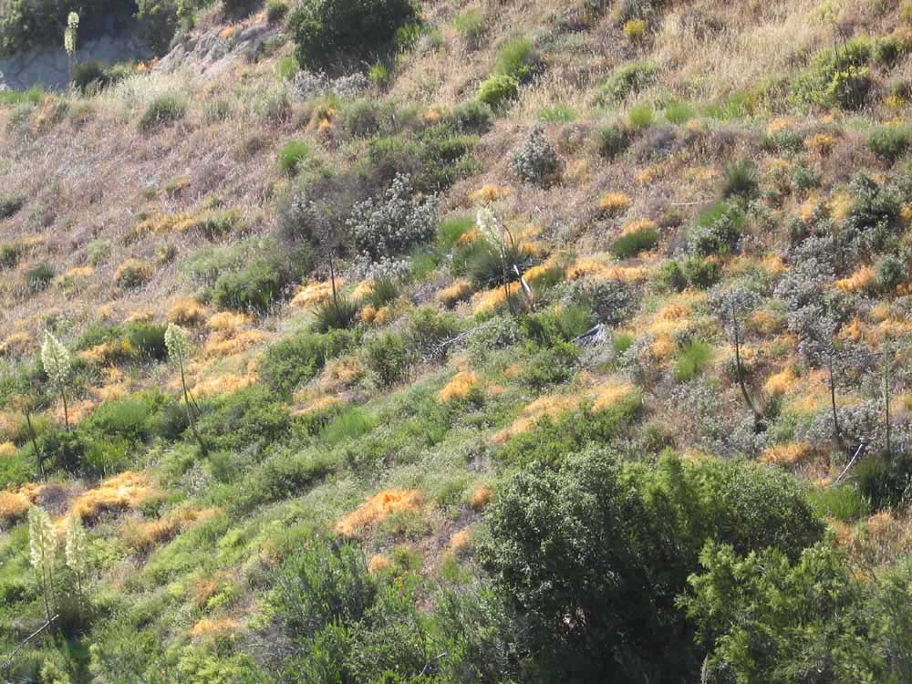
^ ^ ^ About half way to the abandoned Knapp Ranch.....
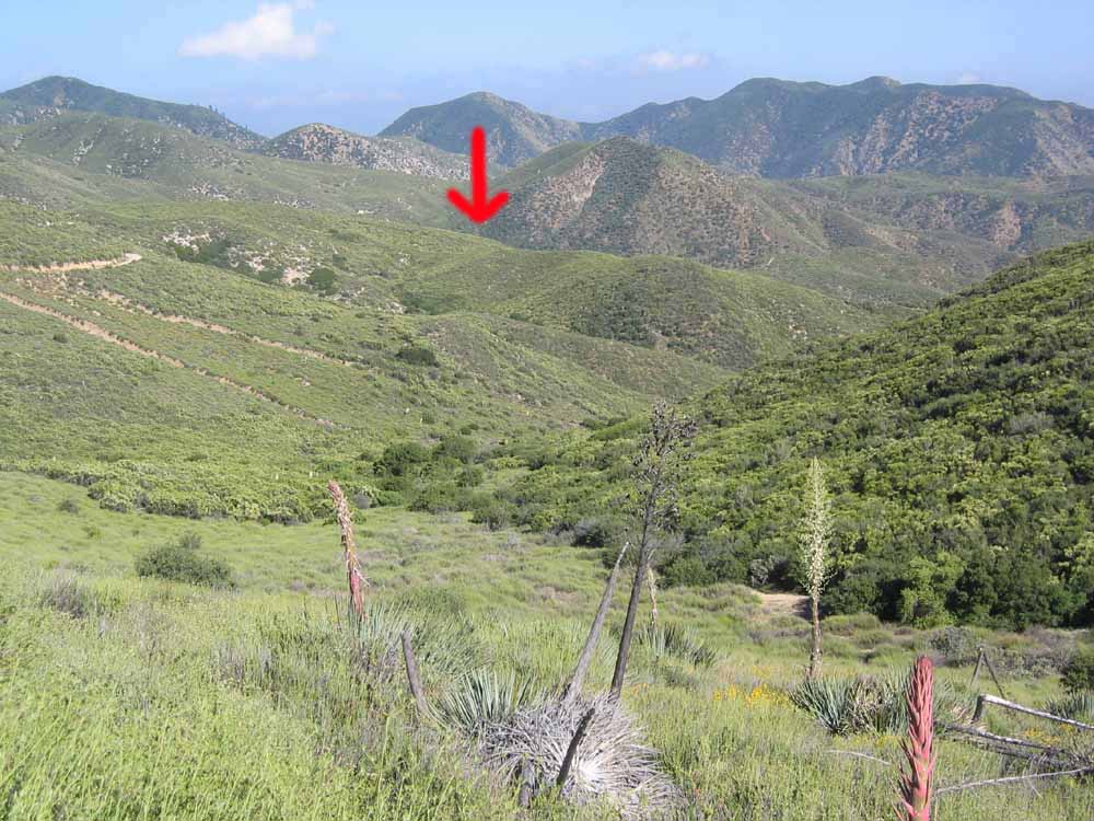
^ ^ ^ The red arrow shows the location of the Knapp Ranch in a very pleasant valley in front of the small mountain in the center middle ground. Bear Canyon is in the larger canyon beyond that (where the old Gillette mine was located but there is no trace of it now). Bear Canyon is probably too far for a casual day hike, unless you leave very early and return late. Better to drive part of the way or as far as you can. The Forestry gate was locked this day but it is usually open. The road is privately maintained so its condition can vary.
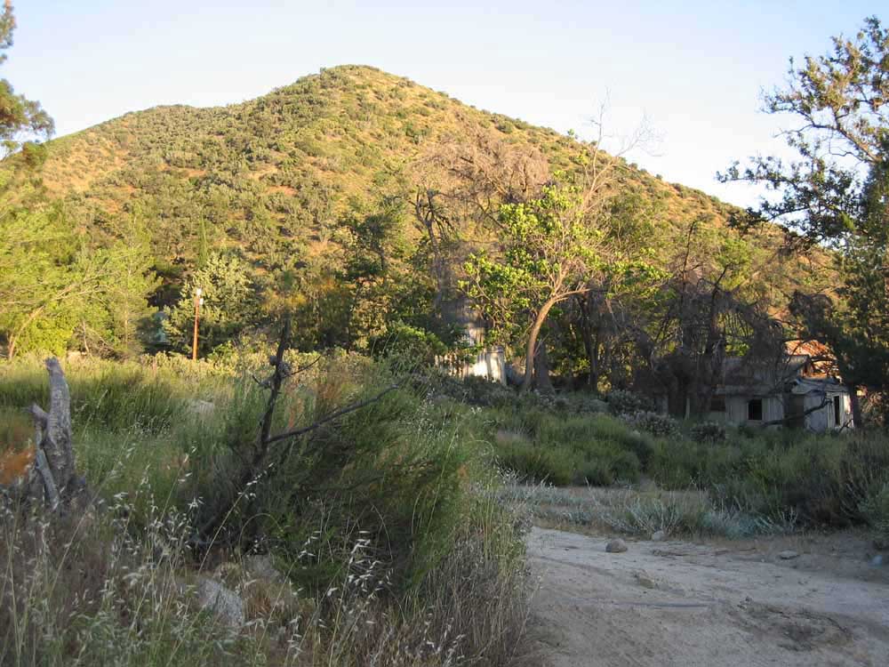
^ ^ ^ Behind a permanently locked gate, the ruins of the old Knapp Ranch appear up ahead.
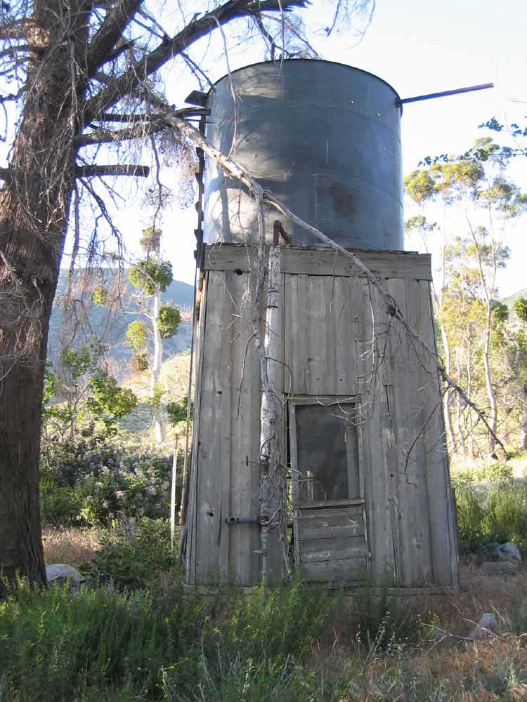
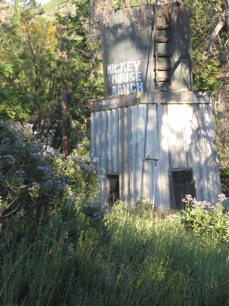
^ ^ ^ I'd be interested to know who painted this sign on the water tank? Not sure if it was done before or after the ranch was abandoned? It doesn't look like graffiti?
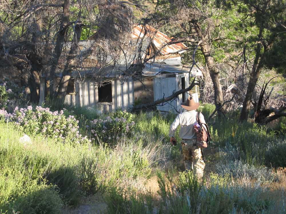
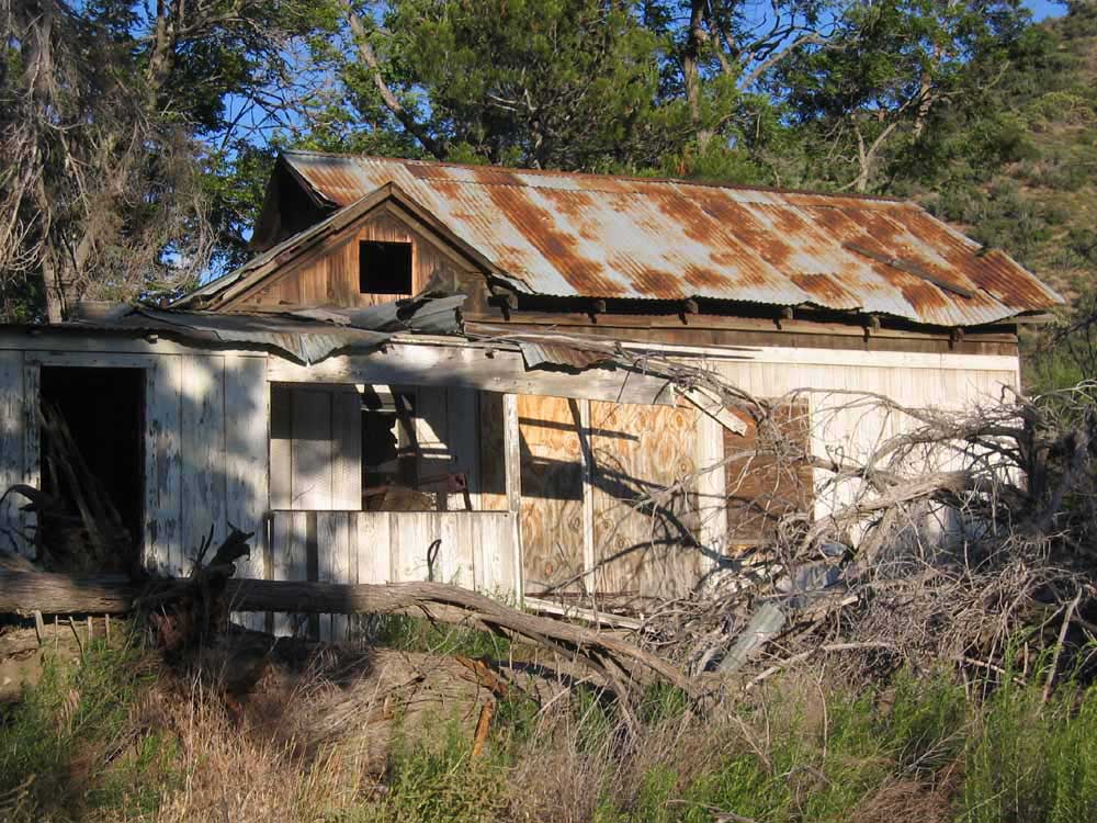
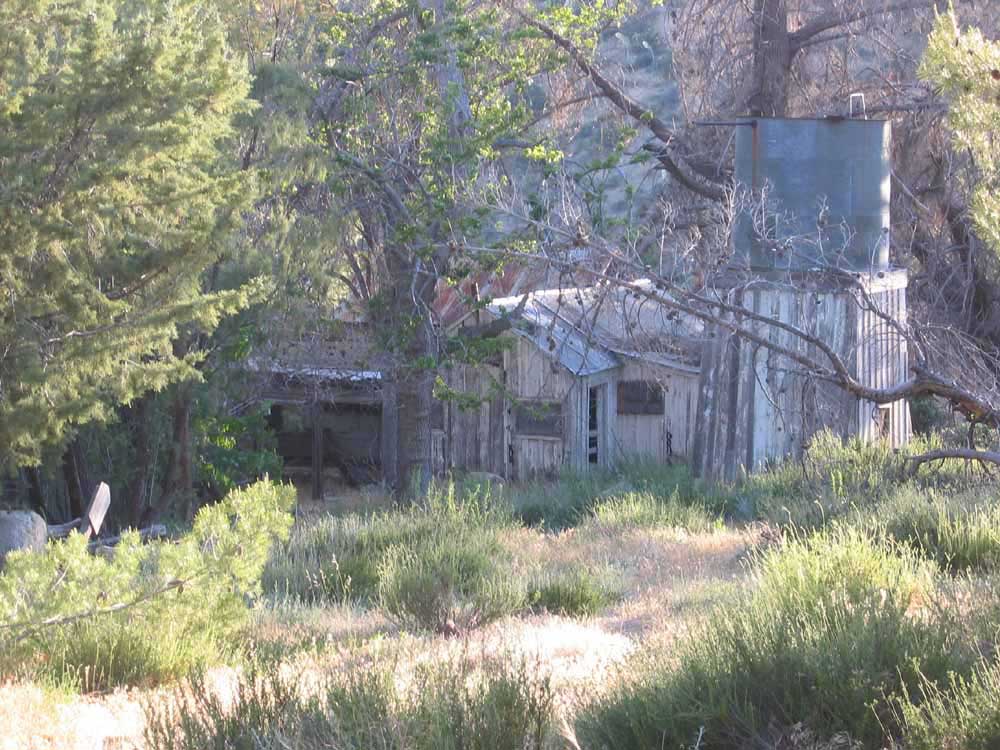
^ ^ ^ The original building possibly built in the late 1890s.
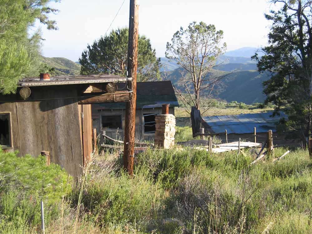
^ ^ ^ A building added later as a guest house.
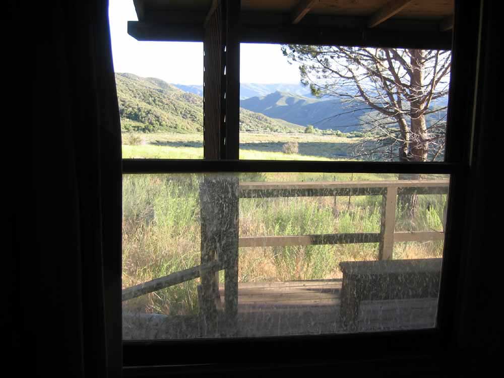
^ ^ ^ View to the south from the guest house.
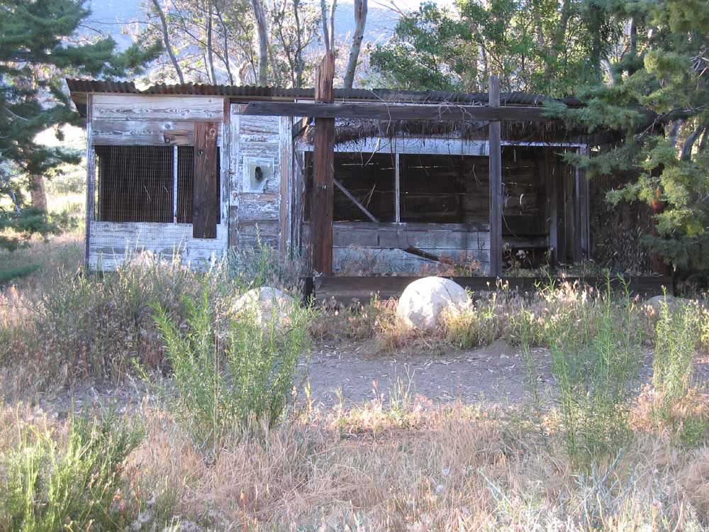
^ ^ ^ The old chicken coup. The chute in the door was used to feed a "pet" Bob Cat.
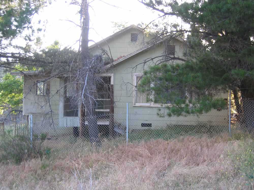
^ ^ ^ This building is the most recent construction. The building style and materials are more modern compared to the other buildings. It was the main homestead up until the ranch was abandoned.
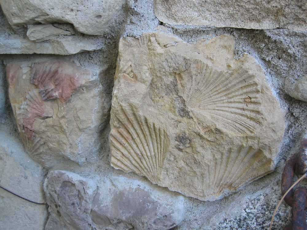
^ ^ ^ Frank Knapp was a skilled stonemason and this is some of his handiwork seen in the foundations of the main house.
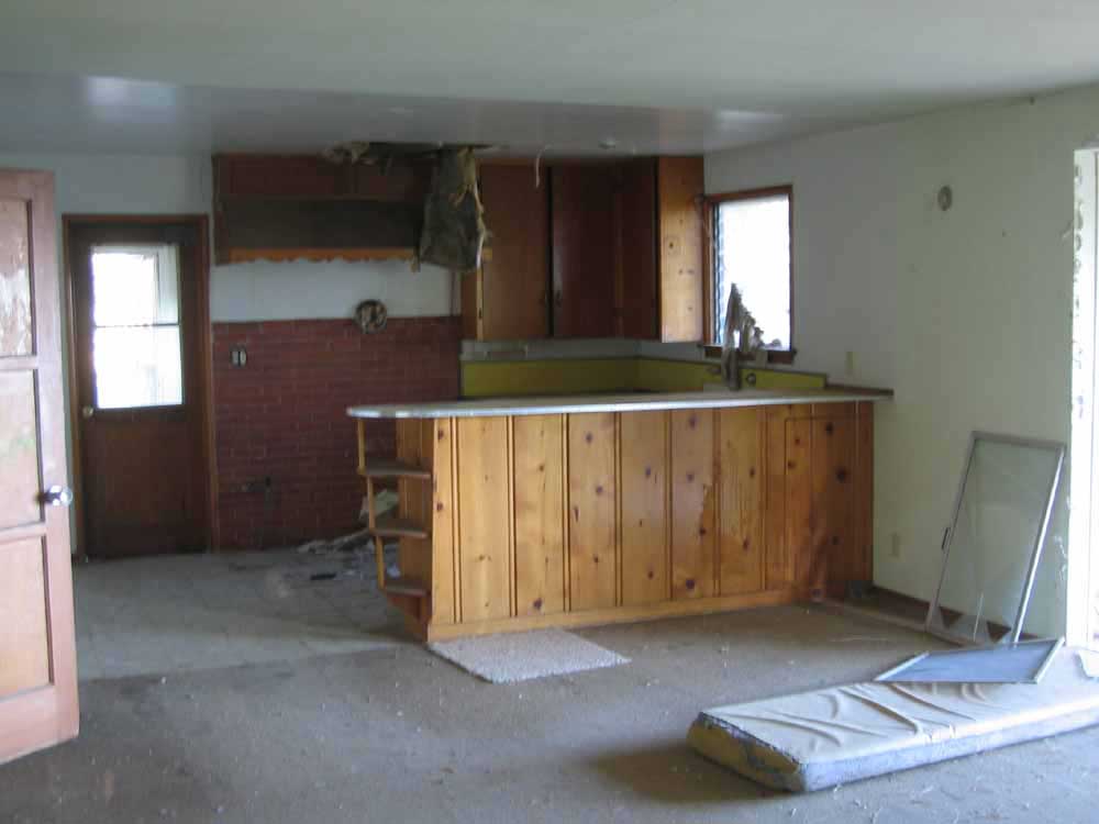
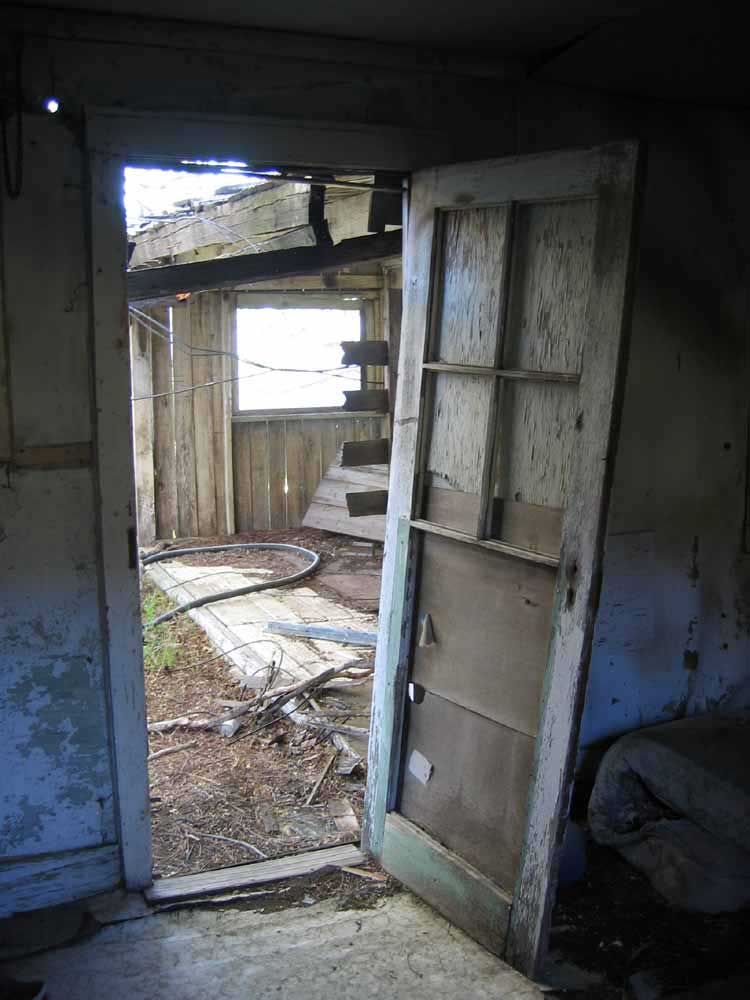
^ ^ ^ Kitchen.
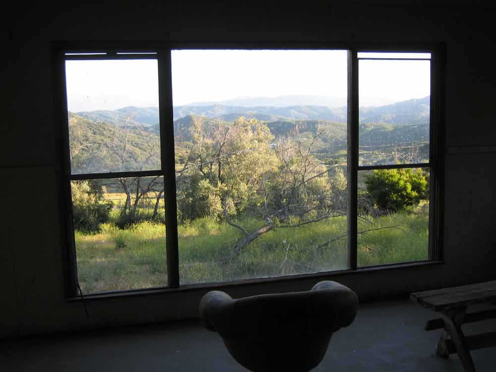
^ ^ ^ Nice view from the living room overlooking an old fruit orchard.
^ ^ ^ The ranch has a wonderful view to the south. There are the remains of an abandoned boy scout camp among the trees is the far distance.
![]()
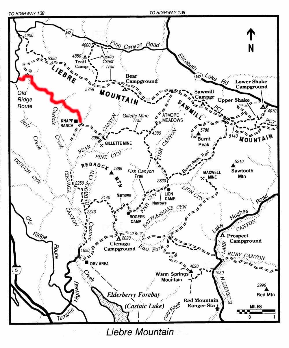
Below is a map of the area. As a matter of interest, the San Andreas Fault roughly follows Pine Canyon Road (N2) just to the north of this area. The Liebre Mountains, lying on top of the eastern edge of the Pacific tectonic plate, is creeping slowly north-west a few centimeters a year relative to the Antelope Valley.
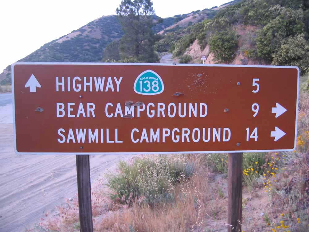
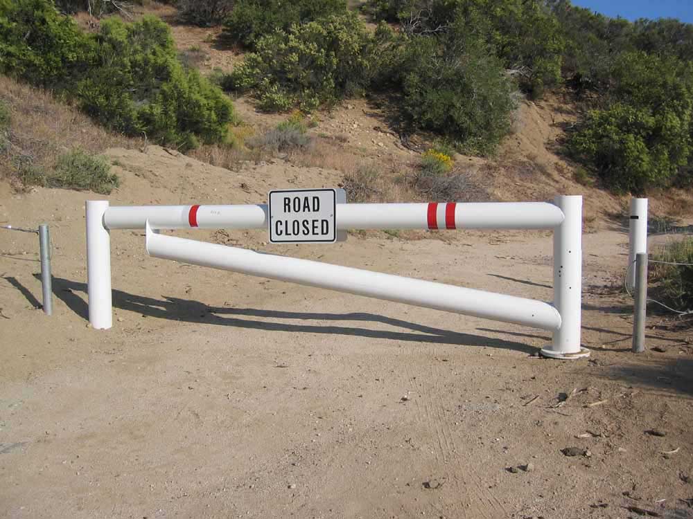
If you want to try this hike, this is how you get to the beginning of the gravel road leading to the Knapp Ranch. These directions assume you are coming from the north (for example, from Pine Mountain Club). Take I-5 south past Gorman, then turn east onto the 138 (direction Palmdale). Drive past Quail Lake, and after about 4 miles from I-5 turnoff, turn right onto Old Ridge Route (Country Route N2) going up the hill. Just beyond this turn off, there is a tower with a windmill sticking out of the top of it, which is very unusual and very distinctive. It used to house an old telephone exchange. Go 2.3 miles up Old Ridge Route and take note of where Pine Canyon Road (West Oakdale Road on older maps) turns off to the left and goes east. Zero (or note) your odometer reading. Continue straight ahead past the "Road Closed" barrier. In less than half a mile (0.4), you will pass the ruins of the old Sandberg Inn and historic marker on your right. After 3 miles (from the "Road Closed" barrier) you come to a sign that says: BEAR CAMPGROUND 9 miles and SAWMILL CAMPGROUND 14 miles. Here is a photo of the sign, but you will be approaching it from the other side. It looks a little different from the side you will be approaching from.
^ ^ ^ Turn LEFT at this sign up a dirt road (you can see the road you go up above the sign in the background). After a sort distance, you come to a forestry gate that was locked on the day we did this hike. So we parked the car and continue walking along the road past this gate (as described below).
You start out on Road #7N23. After about 10 to 15 minutes walking, you come to a branch in the road. Road #7N23 continues on up the hill to Bear and Sawmill Campgrounds. But instead, take Road #7N22 that splits off going downhill on your right. It is roughly 4 or 5 miles(?) down this road to the old Knapp Ranch (formerly Kelly Ranch). There is another locked gate a few hundred yards before you come to the abandoned Knapp Ranch. I'd say it is about a 2.5 to 3 hour hike down to this locked gate at Knapp Ranch. So a long hike to fit into one day, but you can turn back at anytime and retrace your footsteps.
![]()
Peter Gray
telephone: +1 (661) 242-1234