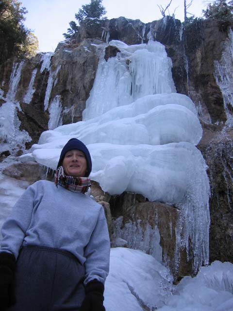
"IRONWOOD" WATERFALL
(5th July 2005)
The waterfall at the top of Woodland Drive (pictured above) is well known among Pine Mountain Club locals and hikers alike. But it may comes as some surprise to know that there is a second, easily accessible, waterfall which is also very close to the edge of the PMC township. It is a seasonal waterfall, which might explain why it can go unnoticed perhaps? We learnt about the existence of this waterfall from a hiking buddy, Sean Mclean, when a group of us were swapping hiking stories one day.
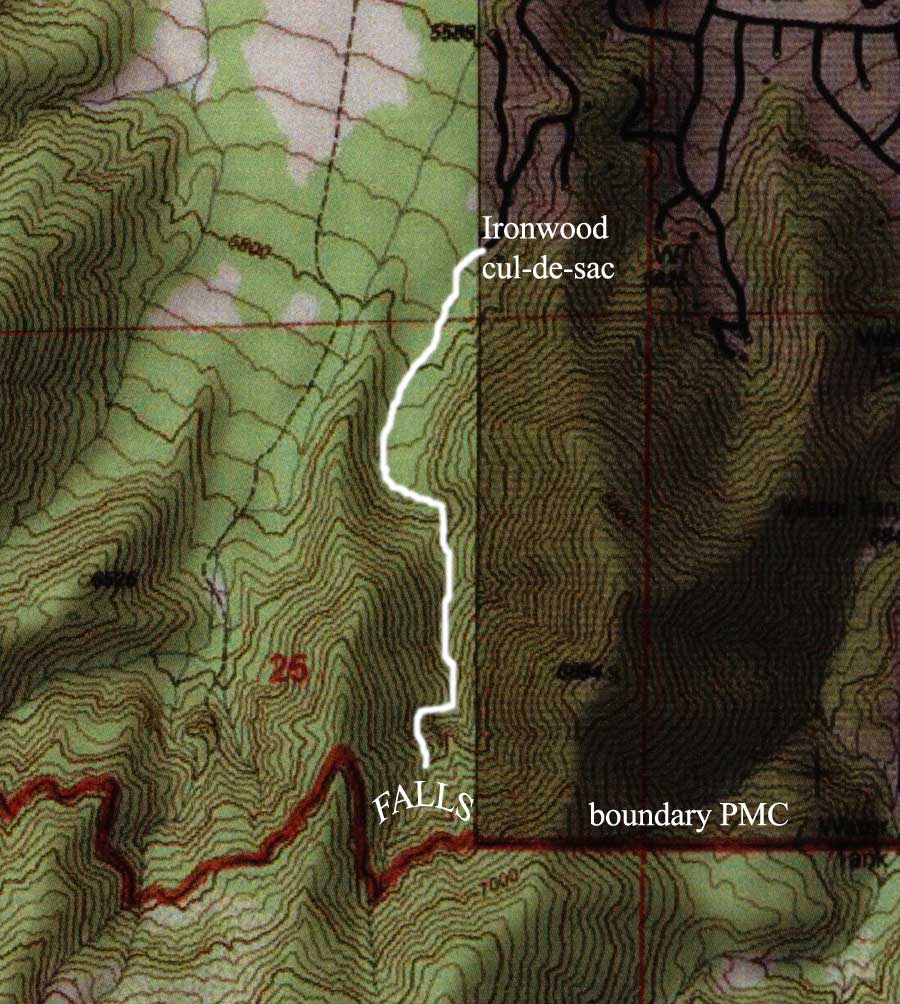
It is a relatively short hike (slightly less than a mile each way) going up a gradually narrowing and fairly steep-sided canyon that is close to the PMC township. The trail runs along the west side of town and the falls are situated adjacent to the south-west corner of the township (see map below). The western boundary of the township runs along the top of the ridge that parallels this canyon with the the hiking trail down below. So it is about as close to the city limits as it is possible to get although the entire route is in the national forest.
There is a trail from the Smokey the Bear sign on Mil Potrero Hwy just west of town, however there is a closer trail head. You can start much closer to your final destination from the Ironwood Drive cul-de-sac in the south-west corner of the PMC township. This is a good starting point, especially if you have limited time. This closer starting point shaves well over half a mile from the hike in each direction.
Hiking at a leisurely rate, hiking time is about 40 minutes to get to the falls and about 30 minutes to return. The gain / loss in altitude is about 500 feet, so you climb gently on the way there and descend slowly on the way back. The hiking distance to the falls is about 0.865 miles (just shy of nine-tenths of a mile). Definitely a great little hike, very pretty area generally speaking, and all that have gone have reported back that they thoroughly enjoyed the hike.
I'm dubbing it the "Ironwood" Waterfall for lack of a better name, seeing this canyon doesn't appear to have an official name on any of the maps I have looked at.
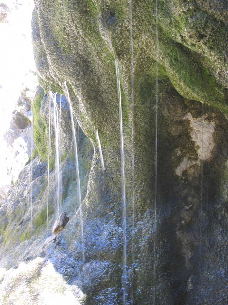
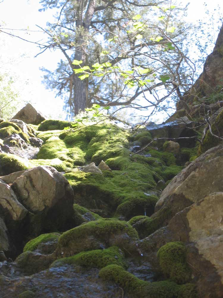
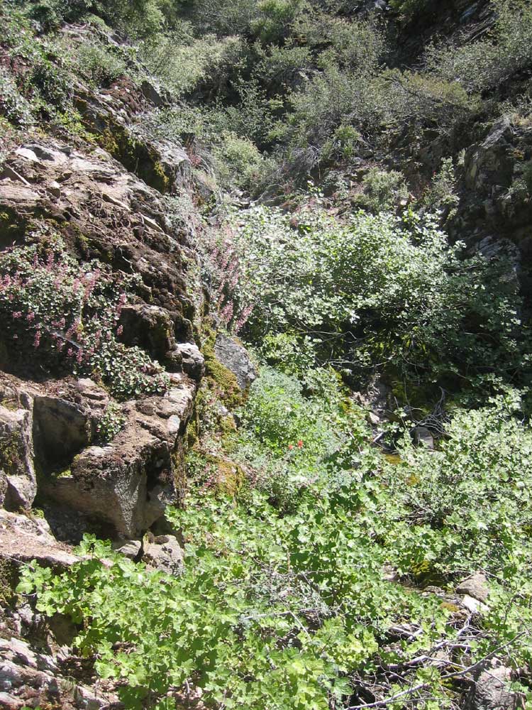
This is a seasonal "waterfall" (or trickle-fall or seepage-fall) which can sometimes be dry, or almost dry. The flow depends on the amount of snow pack and how quickly it melts each year. This wonderful, trickling, moss-covered waterfall is indeed very beautiful...the wetter it gets the nicer it becomes.

My guess is it is most likely to flow between May and August (approximately) and possibly only in "wet" years. The last two "wet" years on record were 2011 and 2005 when ground water flowed readily in the green belt between Alpen Court and Freeman Drive (i.e. Snowflake trails). So I assume the "Ironwood" falls would have also been flowing in those years as well.
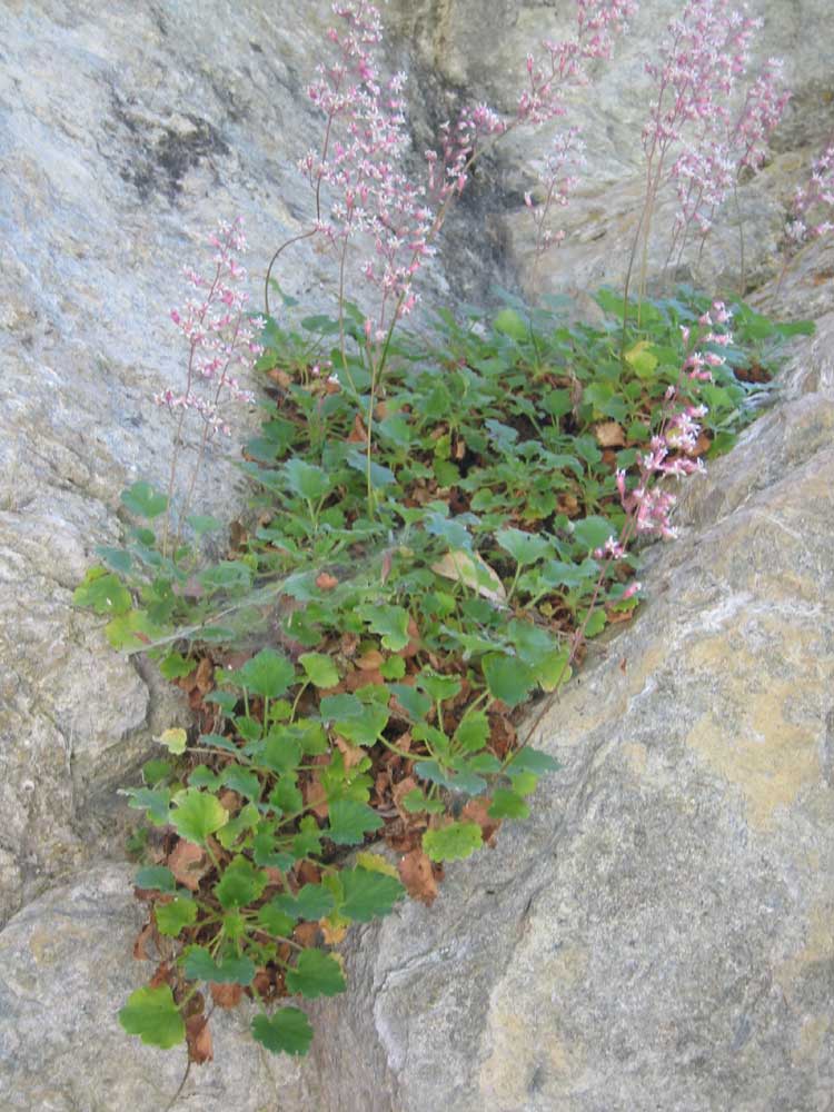
This flowering plant is from the genus, Heuchera. It is a genus of herbaceous perennial plants in the family Saxifragaceae, all native to (originating from) North America. Common names include Alumroot and Coral bells (which reflects the appearance of the ornamental flower). Notice the distinctive clumps of evergreen base foliage and graceful towers of tiny bell-like flowers on very tall, thin stalks. The genus was named after Johann Heinrich von Heucher (1677 - 1746) who was an 18th-century German physician. There are approximately 37 species which can be difficult to differentiate between because of cross breeding. A handful of the species are quite rare. There is a wide array of flower sizes, shapes, and colors, foliage types, and geographic tolerances. The plant tends to bloom in late spring. As a matter of interest, Native American peoples used some Heuchera species medicinally.
Local botanist and expert, Pam De Vries, took a closer look at this photo and concludes it is probably Heuchera caespitosa or Urn-flowered alumroot. She said she can't see the flowers well enough in the photo to be sure of this identification and therefore emphasizes this is a maybe.
This is what it looks like if you scramble up above the waterfall. It is very steep and overgrown up there and difficult to get much higher, so it is up to you if it is worth the effort. But it is a fun scramble if you like scrambling (but please be careful)........
DIRECTIONS: To get to the Ironwood cul-de-sac, drive south down SYMONDS DRIVE past the Fire Station and the heliport. Turn right into CEDARWOOD DRIVE, and then left into IRONWOOD DRIVE. Follow Ironwood Drive until it ends in a cul-de-sac. Park your car, and start hiking more or less due south i.e. continuing in the same direction as the road entering the cul-de-sac. There is also a trail heading west from the cul-de-sac but this is the wrong trail. It is pretty much follow your nose from there. The trail is mostly well defined, except in a few spots where it fades away ........ but it is not difficult to pick it back up again. There are quite a few fallen trees across the trail that you have to navigate around (some have log "stairs" over them). Eventually the canyon narrows, and the trail follows a small creek (usually dry). As you near the waterfall, the trail seems to run into the end of the canyon ahead of you. Here you have come to a fork near the end of the canyon with a spur coming down the middle between two smaller canyons going left and right in a "Y" shape. Just pick up the well pronounced trail again swinging around to the right. The waterfall is a couple of hundred yards up the right fork, which is the larger of the two branch canyons. The trail leads directly to the waterfall, so just keep following the trail..... Enjoy!
Here is a topo map that might help. The hiking distance is just shy of 0.9 miles each way. Allow a minimum of 75 minutes return for a relaxed hike (and more if you like to spend extended time at the falls, maybe for a picnic).
This aerial 3-D relief map (satellite photo) might make the route a little clearer. You are gently climbing up a canyon most of the way so it is hard to get lost provided you stay in the bottom of the canyon.
The GPS coordinates for the falls are Latitude: 34o 50' 40" North and Longitude: 119o 10' 34" West.

![]()
Peter Gray
telephone: +1 (661) 242-1234