HUMMINGBIRD HOYO
(1st February 2011)
The Spanish word "hoyo" means hole. The word has been adopted by "trackers" to refer to holes found in rocks or rock formations. Hoyos are thought to be highly significant markers in the Spanish coding system.
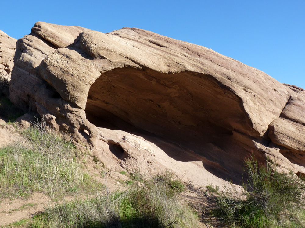
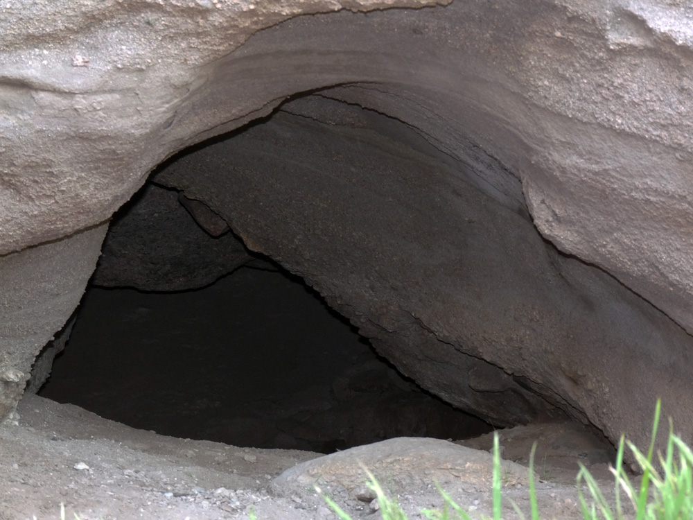
The small hoyo on the left caught my attention drawing me towards this cave.....
The cave contains two hoyos. One obvious and one hidden.
This next photograph shows the most obvious hoyo. This is the hoyo that drew me towards the cave in the first place.....
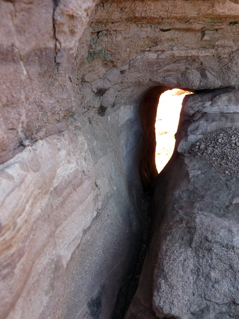
The next photograph shows the position of both hoyos.....
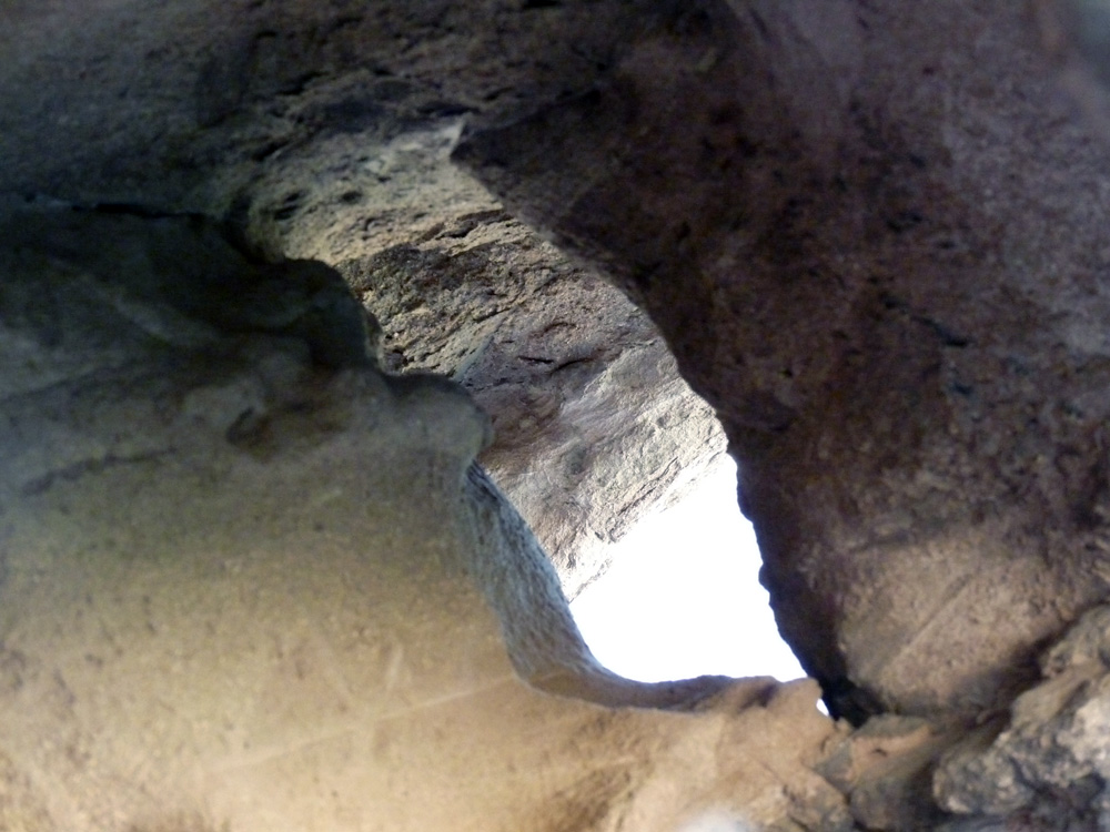
The "obvious" hoyo can be seen down on the lower left. The hidden hoyo is found inside the fissure seen upper right. This fissure is about 4 feet long and goes all the way through to the outside of the rock formation. In the next photo you can see where the fissure emerges on the outside.....
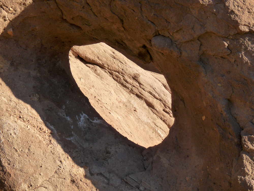
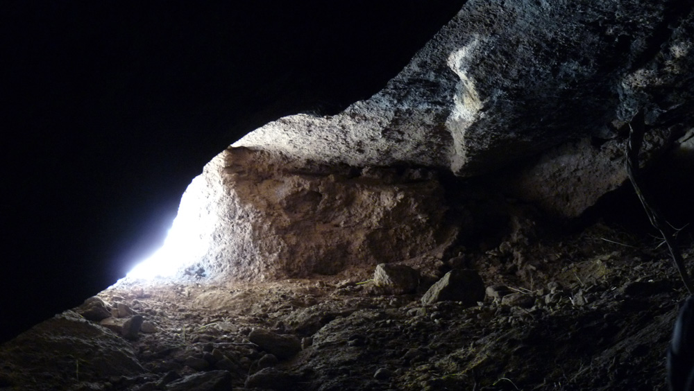
Looking down into this fissure from the outside, we see this bird-like shape.....
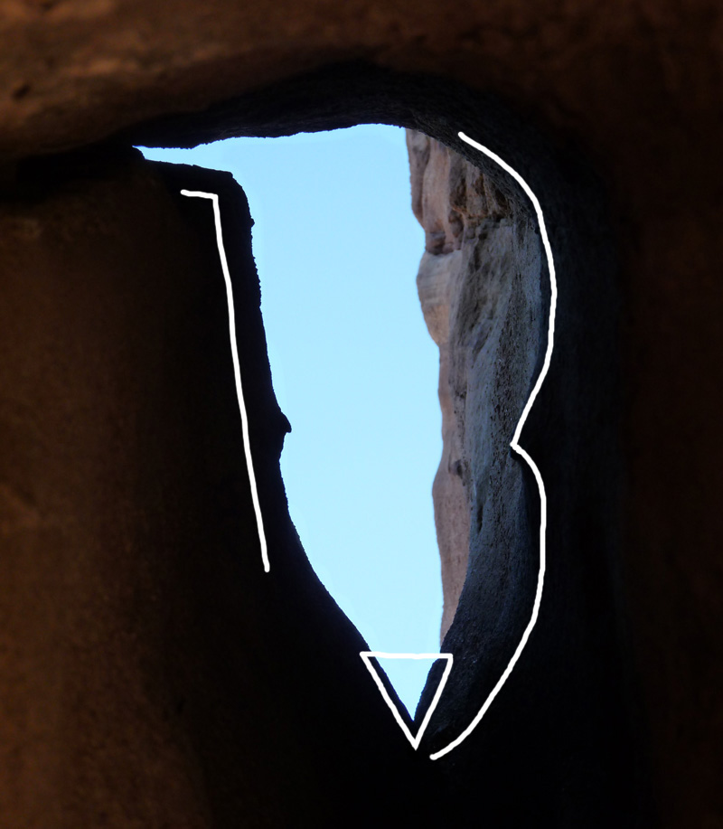
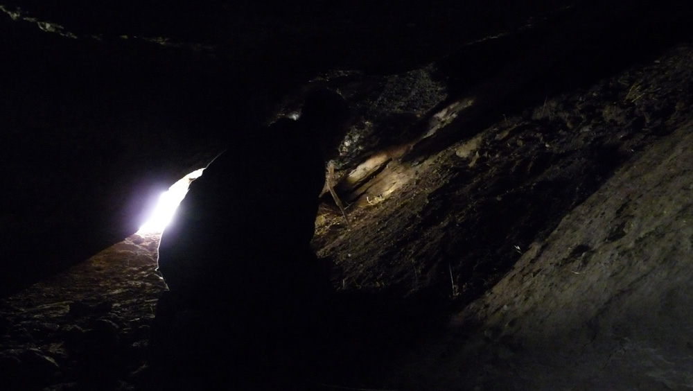
The next photograph shows the same fissure viewed from inside the cave looking outwards.....
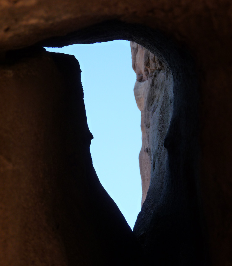
As we see sky through the hoyo, I believe this is the correct point of view, or viewing position.
The shape of the outline reminds me of a humming bird with a long beak.
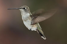
As a Spanish symbol, an image of a bird indicates a change of direction. Especially a humming bird, as it can easily fly in any direction, even in reverse.
Since the theme of this hoyo appears to be associated with a hummingbird, this might suggest a change of direction, or even to go in the exact opposite direction.
There is at least two sets of data incorporated in this hoyo.....
(1). A prominent pointer
(2). A miniature face
The bird's beak appears to be a "pointer" pointing to the left in a westerly direction. I think it is a decoy. I suspect it will point you in the wrong direction if you fail to decode the hoyo correctly.
There is a miniature face which is also a pointer, but much smaller and more subtle. It points in the exact opposite direction as the rather obvious beak pointer. I believe this is the correct direction to follow.
This idea is underlined and reinforced by the hummingbird symbol itself that suggests a change of direction, even to go in the opposite direction. So the hummingbird theme encourages you to follow the direction given by the smaller pointer, and not the larger, in-your-face, and pointer. So I conclude that the smaller, more subtle pointer is the true direction to be followed. It points eastwards.
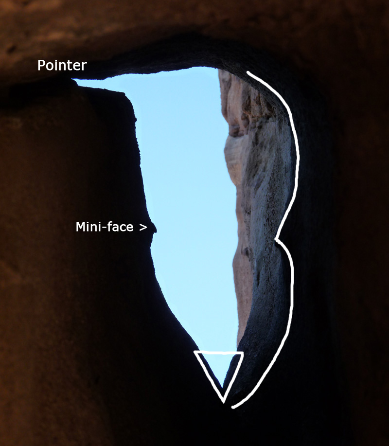
The hoyo may contain additional data. For example, there is a possible number "3". It is a very shallow "3" (as outlined in the photo above). It may not be a number, but instead the shape could represent the wings of a bird in flight. If so, this is another classic Spanish symbol that also means a change of direction. The "3" might also be giving us "distance" information i.e. three units of something? It can also embody both meanings at the same time.
There is also a possible triangle. The bottom angle of the triangle is less than 60-degrees, so it is not quite an equilateral triangle. The angle is approximately 50-degrees, so the other two angels are approximately 65-degrees. A triangle can be an indicator of hidden "wealth." The shape of the hummingbird's body also suggests the number "13". The left side of its body suggests a "1" and the right side suggests a 3 (already described above). The number "13" is highly significant as a Spanish sign since it means this hoyo is pointing to a hidden cache in the vicinity.
However, the "13", the "3" and the "triangle" are not clearly Spanish signs in this particular hoyo. I point them out as possibilities only.
So far, we have established direction, usually the single-most important piece of information to be obtained from any marker.
[Side note: It is not commonly known that the fluttering wings of the hummingbird move in the pattern of the infinity symbol ∞
This adds to the hummingbird's potential for symbolism as a possible representation of
perpetuity, continuity, permanency, timelessness, longevity, persistence, durability, stability, and eternity.]
So far, we have established direction, usually the single-most important piece of information to be obtained from any marker or monument. What about distance? Maybe the "3" in this case is telling us distance. So "3" units of length (such as vara or paces) would mean it is a relatively short distance away. What do we find a relatively short distance away in the direction provided by the mini-pointer?
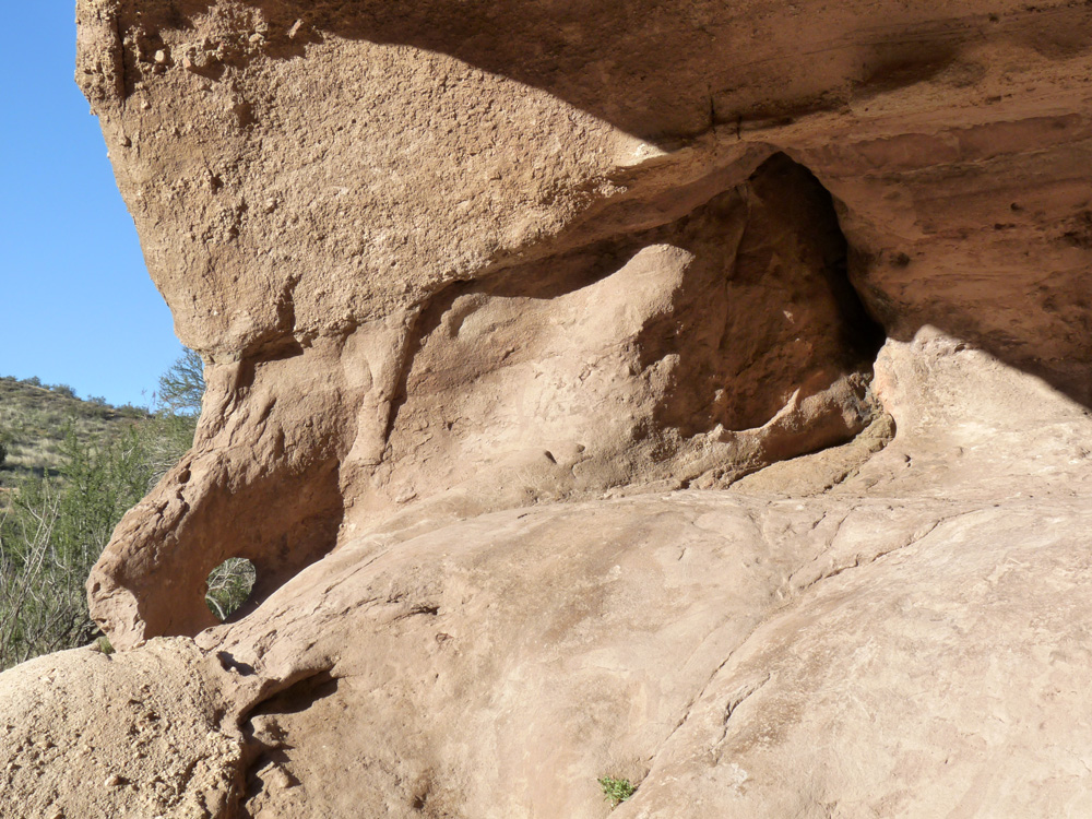
Just a short distance away in the direction indicated, is another hoyo. It is incorporated in a very small cave in the corner of the same outcrop about 15 feet away (5.45 vara or 6 paces). This second hoyo is also in the shape of a bird. The bird shape is very similar...indeed it bears an uncanny resemblance. It has the same bird shape, a prominent beak, and a triangle of similar proportions at the bottom near its tail. The second bird is less distinct, and not as clearly and as graphically represented as the first.
Perhaps significantly, the second hoyo is a mirror image of the first (or sideways inverted). This reinforces the idea that there is a relationship between them.
The back of the bird above (left side of the hoyo) might be a three-dimensional relief map. If you turn around and look south-east from the spot where the above photo was taken, what you see matches the "relief map". There is a smooth-faced cliff about 60 feet high. Above this cliff line, further up, there are two large outcrops on the slope above that are positioned right next to each other. They are separated by a narrow slot-division between them. In other words, the real lay of the land seems to match the three-dimensional "relief map" representation on the side of the hoyo (which is the bird's back).
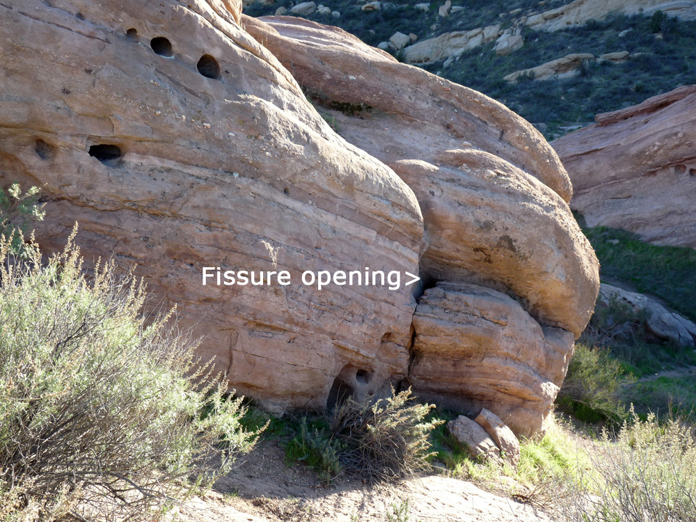
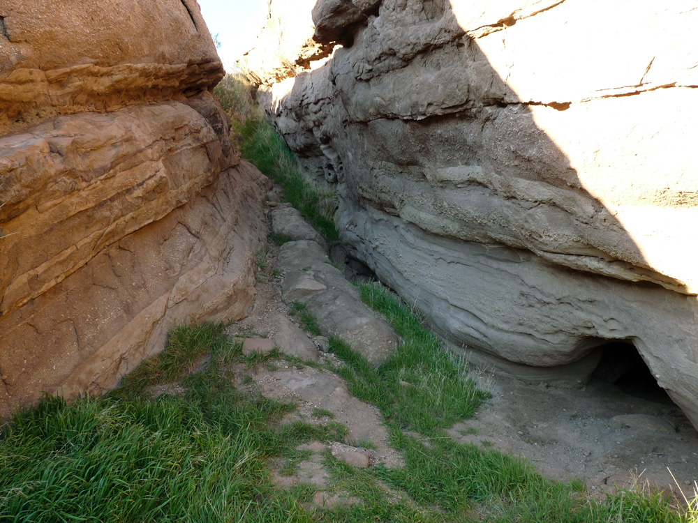
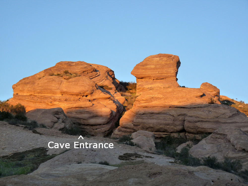
Climbing up to investigate, there is a sizable cave underneath the second outcrop. It is about 360 feet away (as the crow flies) heading in a south-easterly direction. There is an open cave entrance at one end of the slot division (the entrance is seen in the lower right of this photo below).
Here is a closer view of the entrance. There is a short, narrow tunnel that opens out into a much larger cavity or space inside.
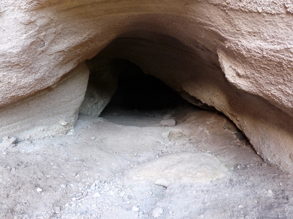
When viewed at a certain angle, the tunnel entrance is heart shaped as suggested in the next photograph (the "heart" is a key Spanish symbol for a hidden cache and can also mean a significant opening).
The narrow entrance opens into a largish interior "room".
The cave was apparently created by the hydraulic action of funneled water over the eons. It is large enough to crawl inside.
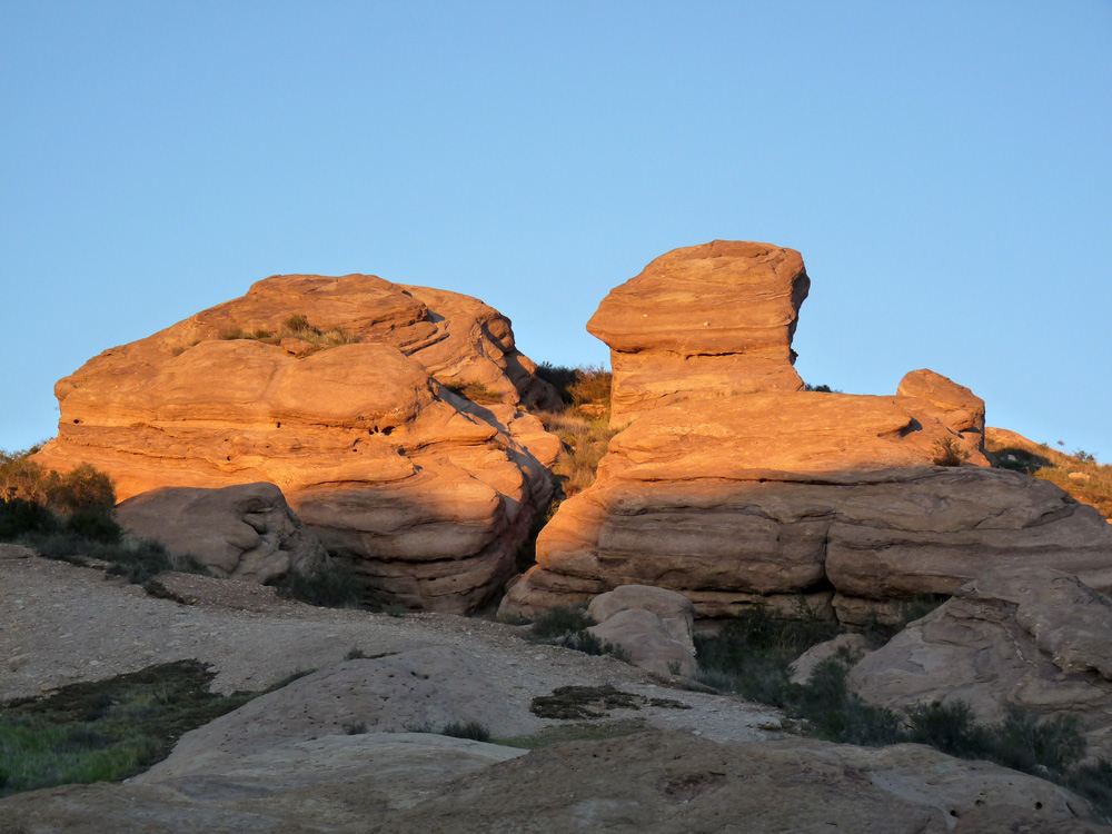
There is evidence of soot on the roof of the cave indicating the use of candles or fires in the past. It is possibly a "cache cave" or "treasure room", which now appears to be empty (or apparently so). If so, the entrance to this cave would have been originally concealed, for example, by a false caliche wall. There is evidence of digging inside this cavity, some of it recent. There is substantial digging in one corner of the cave that occurred since my first visit to this site. The outcrop that incorporates the cave is seen on the left of this next photo. The sphinx-like "dog" on the right "looks" directly at the outcrop with the cave underneath.
Entrance indicated below.....
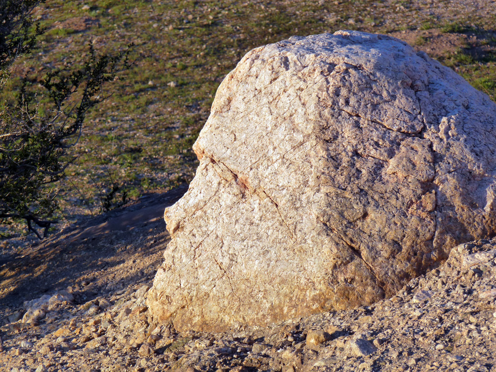
There are several other striking "images" in the immediate area. This next "face" pictured below is on the far side of the same outcrop that contains the cave.
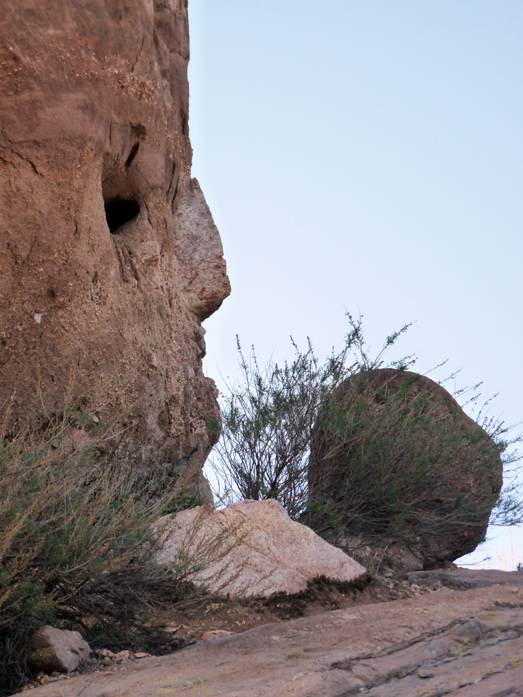
In the next photograph, another face "looks" directly at the location of the hummingbird hoyo (not the cache cave). It is located on the ridgeline above (maybe 100 feet above the hoyo cave).
This interesting outcrop in the next photograph below is situated right next to the hummingbird hoyo cave (about 30 feet away to the north). The side of the outcrop shown in the photograph faces the hoyo cave. There are sets of eyes, animals, and pointers all "looking" in that direction as if to say "look there".
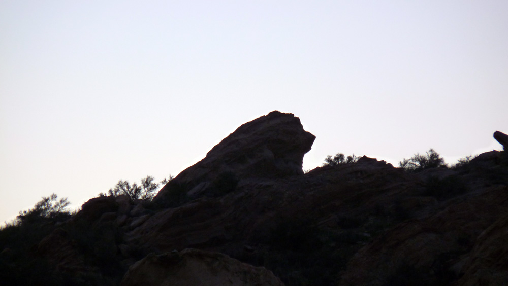
The whole canyon is watched over by this lion patiently waiting forever on guard. The lion is sitting at one end of the canyon containing the hoyo and "cache" caves. The lion looks due west (magnetic) and faces exactly towards a cardinal point on the compass (magnetic west, not "true" west). This sentinel is located a hundred yards or so north of the hummingbird hoyo cave. This type of imagery can be used to mark a "Royal Trail" passing through an area. Such trails are often connected to sites of hidden wealth.
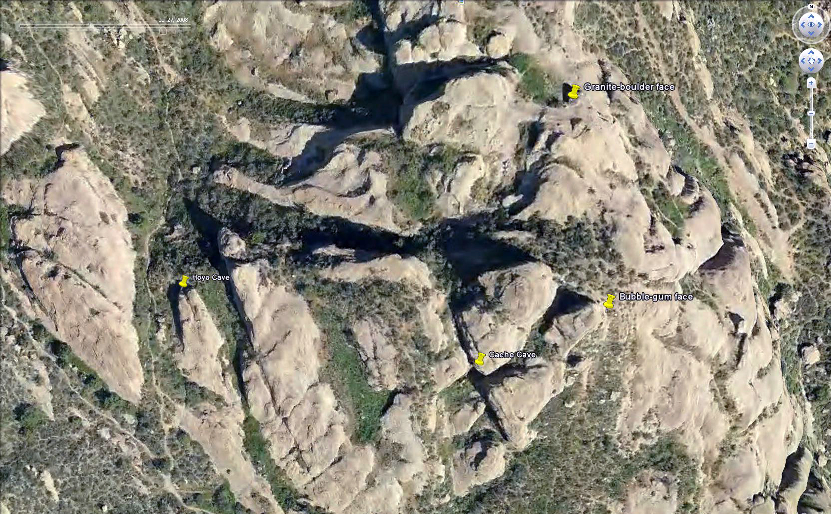
This map (satellite photo) shows the relationship between the key elements.
CONCLUSION:
The relationship between all these things seems to be beyond simple coincidence. Does this mean we are following a genuine Spanish treasure trail? Frankly, I don't think so.
Although compelling in many ways, I suspect the above "imagery" found in the rocks in this area are not of Spanish origin and are not human engineered in any way.
So rather than being the result of intelligent design; they are probably a random mix of natural pareidolia and natural simulacrums.
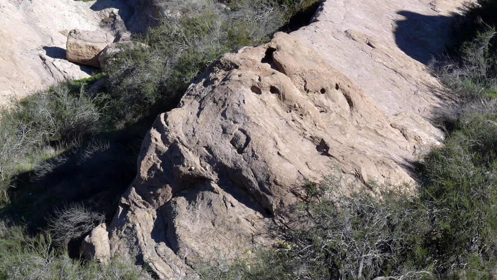
There are plentiful examples of this sort of imagery in the immediate area, especially faces and animals. The entire area is populated with natural
pareidoliac imagery derived from the nature of the geology of the area (which is tilted sandstone strata).
I came to this conclusion because the necessary levels of "confirmation" required by the Spanish coding system seem to be missing. Additionally, there is a lack of the sort of iconic
imagery normally deployed by the Spanish. For example, there are no numbers, letters or geometric shapes. Just faces, birds and animals. The type of iconic imagery that is always found at a
cache site is completely missing (apart from the possible number "13").
I think this is a good example of "cloud reading" which created the illusion I was deciphering an actual Spanish treasure puzzle when I was really being fooled by an abundance of natural
pareidolia and simulacrums in this area. So the apparent relationships I'm seeing are most likely imaginary.
I deduced a plausible relationship between the elements based in part on the Spanish coding system. However, it is probably nothing more than a figment of my imagination.
While there appears to be a relationship connecting all this stunning imagery, I think it is all natural coincidence. Therefore, this is a good example of apophenia.
My reward was enjoying endless hours of fun and intrigue along with the benefit of getting a little exercise to boot. Following false trails is inevitable. So don't be discouraged by this as it
is a necessary part of the learning process. You can actually learn a lot from following false trails.
Post script: I should qualify my conclusions by saying other colleagues believe there is adequate "proof" to conclude that the Spanish were active at Vasquez Rocks. At least to the extent of
marking a route through the area thought to be a Royal Road. This route is marked by images of lions which is a symbol of Spanish royalty. I dispute this because of the historical time frame.
![]()
Peter Gray
telephone: +1 (661) 242-1234